 Choose your stage
Guides
Language
EnglishCurrency
US dollar · $Your currency applies on GetYourGuide too.
Guide · Planning the walk
Kumano Kodo walk map, stage by stage
This Kumano Kodo walk map turns the Nakahechi into numbers you can plan with: how far each stage runs, how long it takes, how much you climb, and how the days fit together.
Check availabilityfrom $103 · cancellation is free
Editorial team, kumanokodohike.comUpdated October 22, 20266 minutes to read72 sources
Quick answer
- 01Takijiri to Hongu
- About 38 km on foot, the classic Nakahechi pilgrimage.1
- 02Longest day
- Chikatsuyu-oji to Hongu, about 24.5 km and 9 to 12 hours.2
- 03Hardest climb
- Ogumotori-goe, rated 5 of 5, about 1260 m up.3
- 04Shortest plan
- The bureau's highlight walks take 3 days and 2 nights.4
- 05Paper maps
- Printed maps are handed out at information centers.5
How to read the trail on a map
The Nakahechi is drawn on every map as a line from Takijiri-oji, inland from Tanabe, east through the villages of Takahara and Chikatsuyu to Kumano Hongu Taisha, then south over the mountains to Kumano Nachi Taisha. The map block on this page shows those stops in order. The Tanabe City Kumano Tourism Bureau splits the line into sections, each with its own distance, time, climb and difficulty rating, and those numbers are what you plan with.
The ratings run from 1 to 5 and combine six criteria: distance, time, height gained and lost, terrain, access by bus and how remote the section is.6 Treat them as a starting point. The bureau gives its own example: very hard rain, a heavy backpack and tired legs can turn a section rated 3 into a 5.7
Times need the same care. On the bureau's difficulty table they leave out breaks and assume a healthy walker with no pack in good weather.8 Real days are longer once you stop at oji shrines, eat lunch on a rock and take photos. Plan to arrive between 15:00 and 17:00, as the bureau suggests, and you will rarely be caught out by the dark.9
A Takijiri to Nachi plan
Takijiri to Nachi with a rest day
-
First day
Takijiri to Chikatsuyu
About 13.3 km and 6 to 8 hours of walking.10
-
Second day
Chikatsuyu to Hongu
-
Rest day
Rest in Hongu
Dainichi-goe to Yunomine, about 2 km.12
-
Mountain day
Hongu to Koguchi
About 13 km, around 5 hours 30 minutes.13
-
Last day
Koguchi to Nachi
About 14.5 km and 7 to 8 hours of walking.14
Takijiri-oji to Chikatsuyu: the first day
Most multi-day walks start at Takijiri-oji, where the Kumano Kodo Kan pilgrimage center has introductory exhibits.1516 The first 4 km to Takahara are a steep climb of about 430 m through native and planted forest, 2 to 3 hours on the bureau's figures.1718
If you stop at Chikatsuyu, the full first day is about 13.3 km and 6 to 8 hours, with about 1010 m of climbing, rated 3.10 Going on to Tsugizakura-oji makes it about 17 km and 7 to 10 hours, with about 1260 m up, rated 4.19 Chikatsuyu-oji itself sits in a basin at about 300 m, and the village has only around 450 people.2021
One timing warning matters for anyone arriving from the cities. The bureau says that even on the earliest train and bus from Osaka or Kyoto, there is not enough time to finish the walk from Takijiri to Chikatsuyu or Nonaka the same day.22 Sleep in Tanabe the night before, or end the first day early in Takahara.23
Stage table
Nakahechi sections at a glance
| Section | Distance | Walking time | Rating |
|---|---|---|---|
| Takijiri to Takahara | About 4 km | 2 to 3 hrs | 2.5 |
| Takijiri to Chikatsuyu | About 13.3 km | 6 to 8 hrs | 3 |
| Chikatsuyu to Hongu | About 24.5 km | 9 to 12 hrs | 4 |
| Hosshinmon to Hongu | About 7.5 km | 2 to 3 hrs | 2 |
| Hongu to Yunomine | About 2 km | 1 to 2 hrs | 2 |
| Ukegawa to Koguchi | About 13 km | 4.5 to 6 hrs | 4 |
| Koguchi to Nachi | About 14 km | 7 to 9 hrs | 5 |
| Daimon-zaka slope | About 1 km | About 30 min | 1.5 |
Course data of the Tanabe City Kumano Tourism Bureau; times vary by walker.17102261224327
Walk it with a guide
Three guided ways to cover the stages
Choose your stage Half day
 With two nights
Decision helper
How much of the trail fits your days?
Find the time you have in the left column
For example, if it is raining very hard, you are carrying a large backpack, and fatigued, a 3 ranked course can easily become a difficulty of 5.
Into Hongu: the long second day and its short cuts
From Chikatsuyu-oji to Kumano Hongu Taisha is the longest stage, about 24.5 km and 9 to 12 hours, with about 1100 m of climbing and rated 4.2 From Tsugizakura-oji it is about 21 km and 8 to 11 hours.25 There are no restaurants on the way, so bring lunch from your inn.30
Local buses make this day flexible. The bureau's own options include walking from the Kobiro-toge bus stop, about 19 km and 7 to 10 hours, or simply the last part from Hosshinmon-oji.11 That final section is about 7.5 km and 2 to 3 hours, rated 2, and mostly downhill with about 460 m of descent.26
The last kilometres are the emotional high point of the Nakahechi. At Fushiogami-oji pilgrims fell to their knees at their first sight of the grand shrine in the valley below.31 Whatever you choose for this day, make the descent past Fushiogami into Hongu part of it.
Map
The Nakahechi, its shrines and the way in from Osaka
The trail from Takijiri-oji to the three Grand Shrines, the Hongu area with its hot springs, the Nachi sanctuary up close, then the whole peninsula with the stations you arrive at.
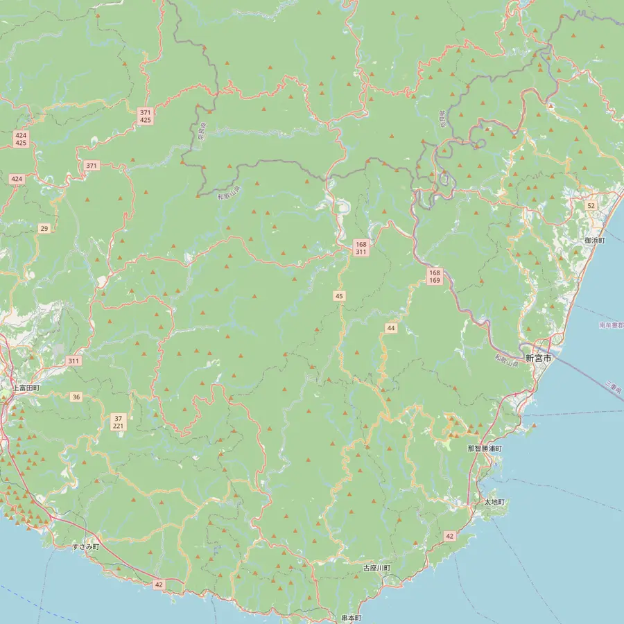 1Takijiri-oji2Takahara3Chikatsuyu-oji4Tsugizakura-oji5Hosshinmon-oji6Kumano Hongu Taisha7Koguchi8Kumano Nachi Taisha9Hayatama Taisha
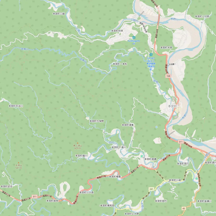 10Fushiogami-oji11Oyunohara12Yunomine Onsen13Wataze Onsen14Kawayu Onsen
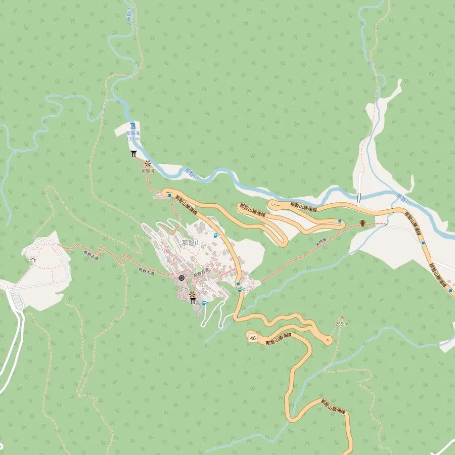 15Daimon-zaka16Seiganto-ji17Nachi Falls (Hiro-jinja)
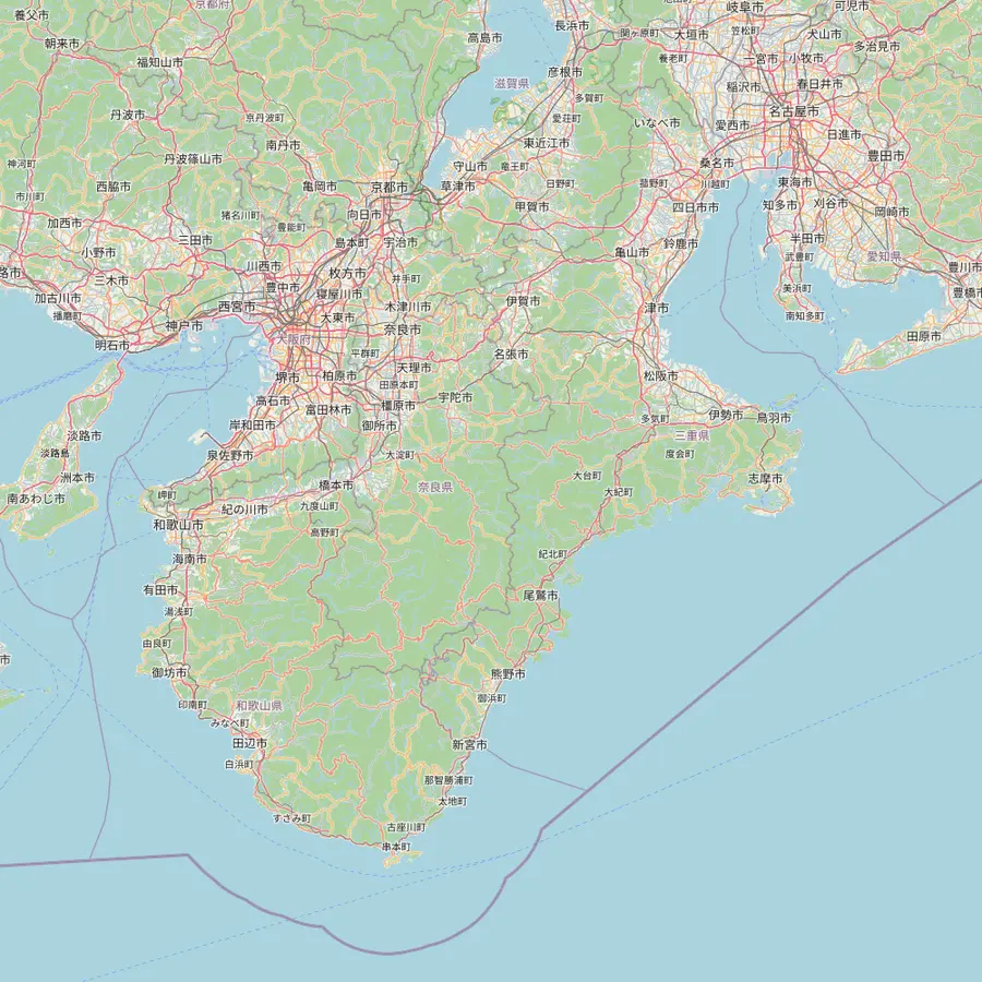 18Osaka (Shinsaibashi)19Kyoto20Koyasan21Kii-Tanabe22Shingu23Kii-Katsuura24Ise
- 1Takijiri-oji
The usual first day of a Nakahechi walk starts here, beside the Kumano Kodo Kan pilgrimage center.1516
In Google Maps ↗ - 2Takahara
A steep climb of about 4 km from Takijiri-oji, through native and planted forest.1718
In Google Maps ↗ - 3Chikatsuyu-oji
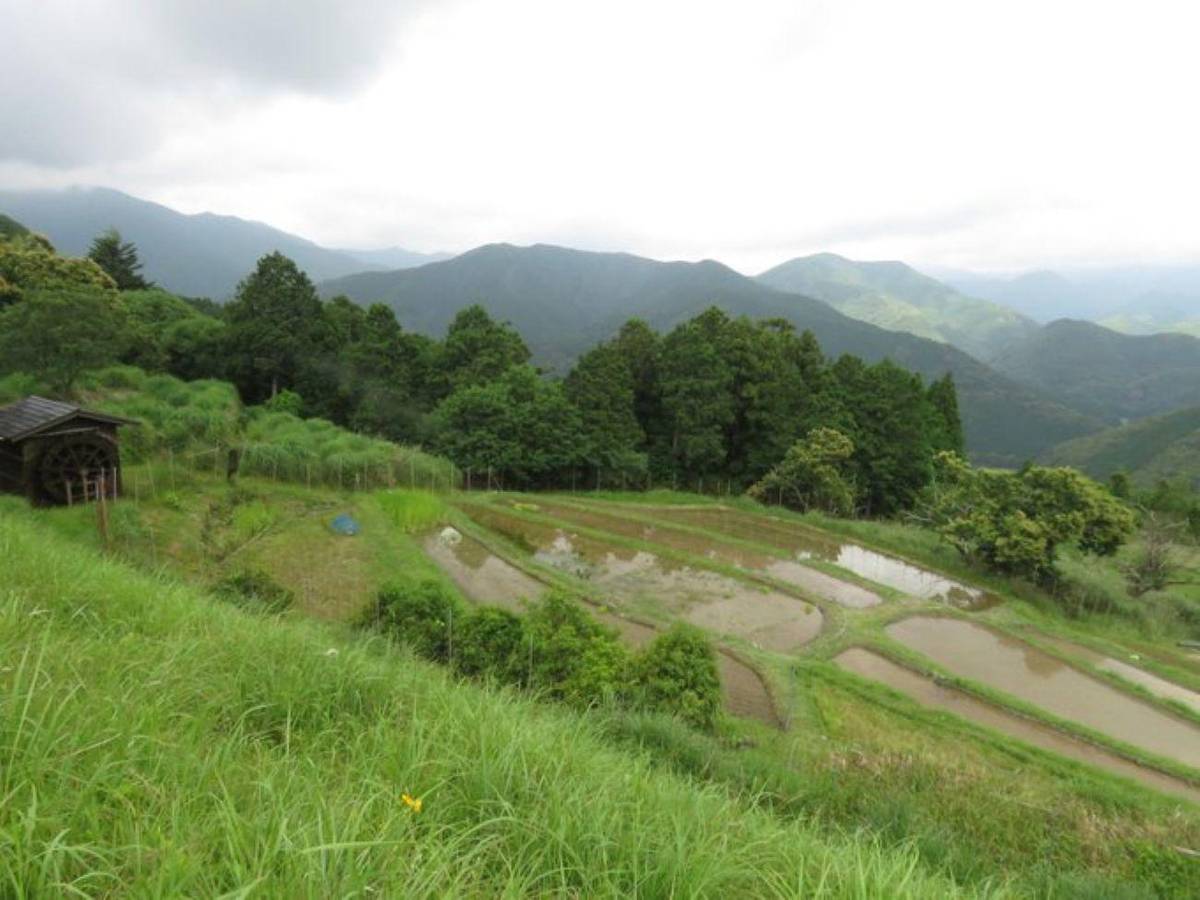
An old oji in a basin at about 300 m, at the end of the classic first day; the village has about 450 people.2021
In Google Maps ↗ - 4Tsugizakura-oji
Named for a grafted cherry; some of its cedars are 8 m round and thought to be up to 800 years old.32
In Google Maps ↗ - 5Hosshinmon-oji
Start of the popular 7 km half-day walk to Kumano Hongu Taisha; there is nowhere to stay here.3334
In Google Maps ↗ - 6Kumano Hongu Taisha
Head shrine of over 3,000 Kumano shrines across Japan; the grounds are free.3536
In Google Maps ↗ - 7Koguchi
Overnight stop between the Kogumotori-goe and the Ogumotori-goe on the way to Nachi.1314
In Google Maps ↗ - 8Kumano Nachi Taisha
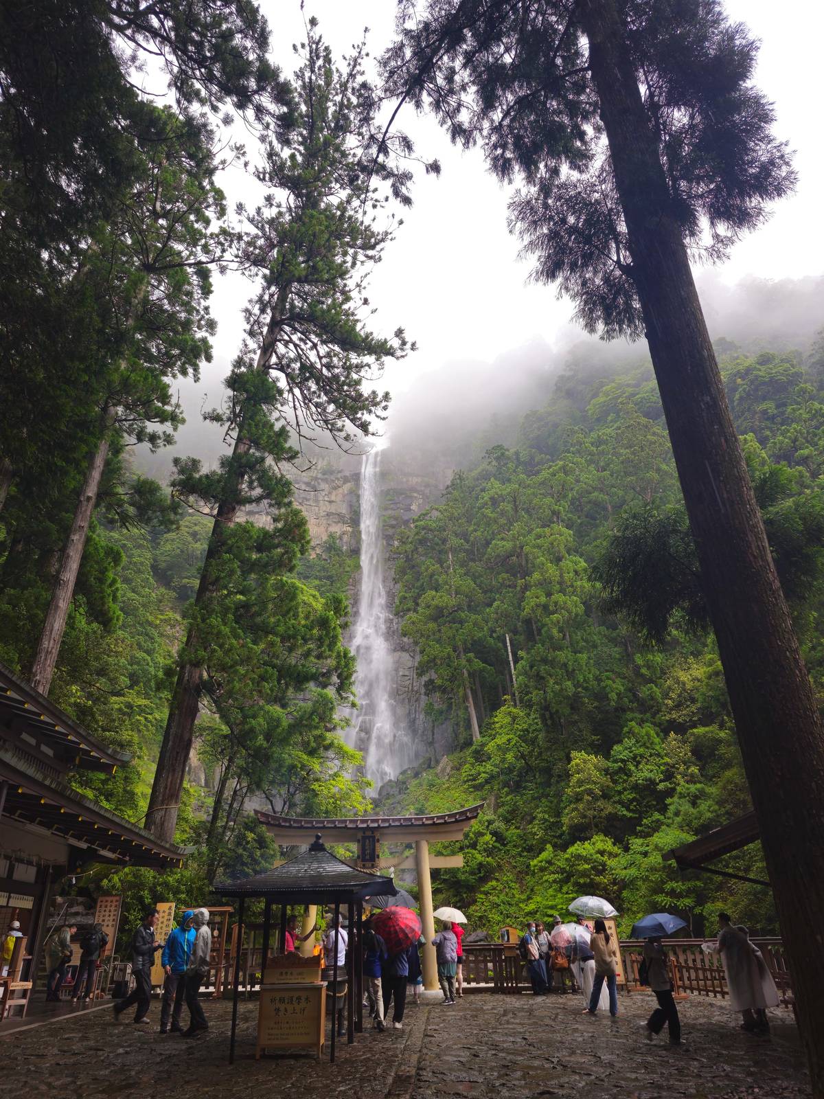
Halfway up Nachi Mountain at about 350 m, about 10 km inland from Katsuura.3738
In Google Maps ↗ - 9Hayatama Taisha
At the mouth of the Kumano-gawa, where the river meets the Pacific.39
In Google Maps ↗ - 10Fushiogami-oji
Where pilgrims fell to their knees at their first sight of the grand shrine.31
In Google Maps ↗ - 11Oyunohara
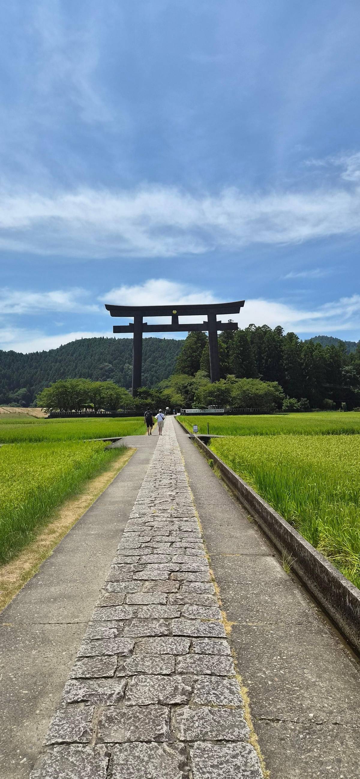
The original shrine site on a sandbank, marked by a steel torii 33.9 m tall.4041
In Google Maps ↗ - 12Yunomine Onsen
A hot spring found about 1,800 years ago, with the Tsuboyu bath.4243
In Google Maps ↗ - 13Wataze Onsen
The largest open-air hot spring bath in western Japan.44
In Google Maps ↗ - 14Kawayu Onsen
Hot water rises through the river bed; in winter a huge river bath is dug.4546
In Google Maps ↗ - 15Daimon-zaka
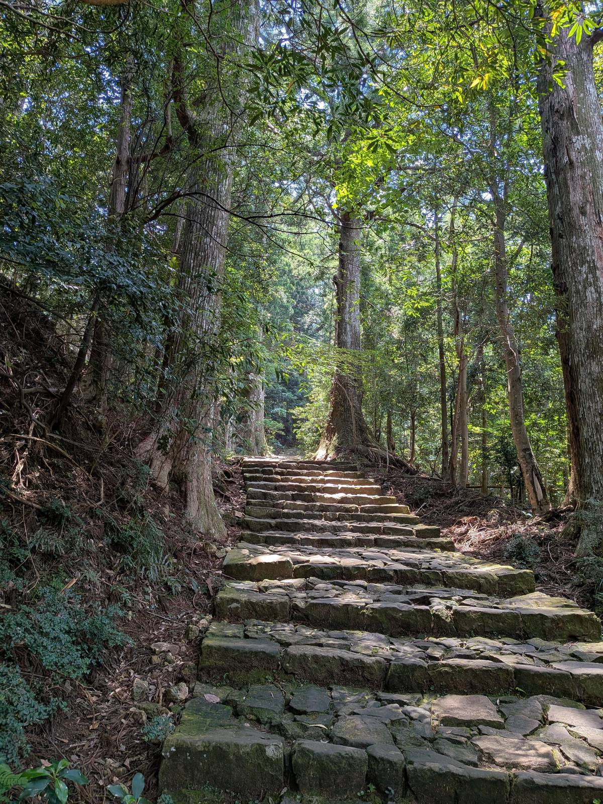
About 600 m of stone stairs, 267 steps, under old cedars.4748
In Google Maps ↗ - 16Seiganto-ji
A Tendai temple and the first stop of the Saigoku pilgrimage to 33 Kannon.49
In Google Maps ↗ - 17Nachi Falls (Hiro-jinja)
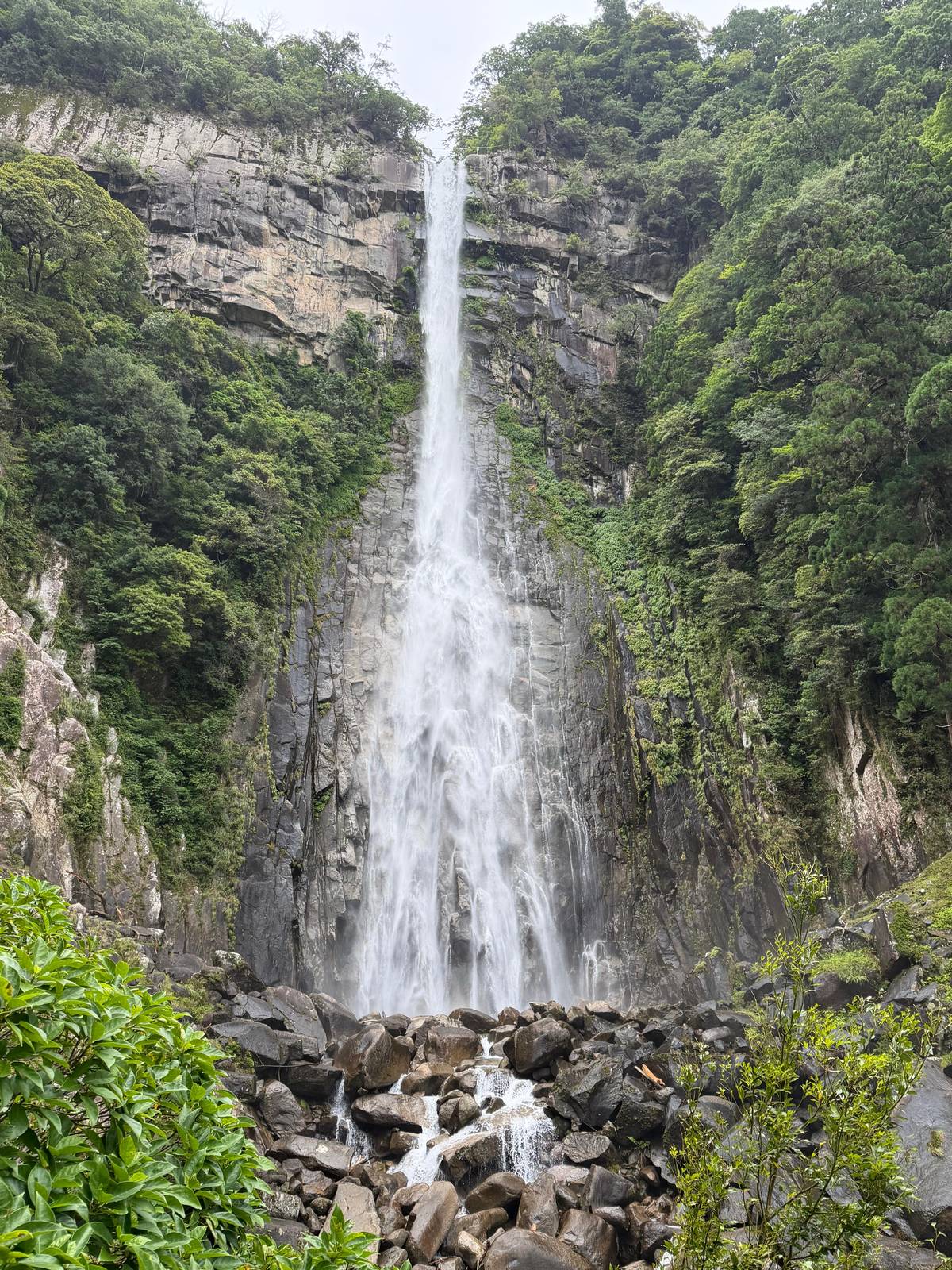
133 m high, worshipped directly with no shrine hall.5051
In Google Maps ↗ - 18Osaka (Shinsaibashi)
The day tour leaves from Q Plaza Shinsaibashi or the National Bunraku Theatre.
In Google Maps ↗ - 19Kyoto
The Kuroshio reaches Kii-Tanabe from Kyoto in 2 hrs 35 min.52
In Google Maps ↗ - 20Koyasan
Start of the Kohechi; reached from Namba on Nankai trains and a cable car.5354
In Google Maps ↗ - 21Kii-Tanabe
Gateway to the Nakahechi; trail buses leave from stop No. 2.5556
In Google Maps ↗ - 22Shingu
Home of Hayatama Taisha and a bus hub towards Hongu.3957
In Google Maps ↗ - 23Kii-Katsuura
Buses climb to Nachisan in about 30 minutes.58
In Google Maps ↗ - 24Ise
Start of the Iseji, about 170 km along the east coast.59
In Google Maps ↗
Checklist
Planning the stages
01
Before you go
- A bed booked at the end of every stage
- The bus stops where a day can be cut short
- An early start to arrive by mid-afternoon
02
On the trail
- A paper map and the signpost numbers
- Water and lunch for days without shops
- Poles for the long descents
Video
Walking Japan's Ancient Pilgrimage Trail - Complete Guide to Kumano Kodo Nakahechi Route
The video loads only when you tap play.
Hongu to Nachi over the mountains
Beyond Hongu the trail continues over the mountains. The bureau's two-day plan walks from Hongu to Koguchi, about 13 km and around 5 hours 30 minutes, then from Koguchi to Kumano Nachi Taisha, about 14.5 km and 7 to 8 hours.1314 Koguchi is the small village in between where you sleep.
The first, the Kogumotori-goe, climbs and drops over a pass and is rated 4, with about 670 m up and 690 m down.24 The bureau calls it the lesser of the two harder walks on the Nakahechi.60 The second is a different matter, and it is the one people mean by a hard day in Kumano.
On the map the Ogumotori-goe looks short, about 14 km.3 On the ground it takes 7 to 9 hours, gains about 1260 m and is rated 5, the top of the scale.3 The reward comes near the end, when the Funami-jaya teahouse remains look out over the Pacific and the fishing village of Katsuura on a clear day.61
The hardest section, in numbers
If you are looking for the Kumano Kodo hiking course for strong walkers, it is the Ogumotori-goe from Koguchi to Nachi. The bureau names it one of the toughest sections of the Nakahechi.62 Its first stretch out of Koguchi gains 800 m in about 5 km, a slope long known as Dogiri-zaka, the Body-breaking Slope.63
Strong walkers handle it by starting early, carrying enough water and lunch, and taking the descent slowly. The route has no shops, and the old stone steps are slippery when wet; the bureau notes that most injuries on the Kumano Kodo are slips and falls on stone and roots.64 Walking poles help on the long way down.
If you want some of the scenery without the full day, walk it in reverse from Nachi only as far as you like, or replace it with the bus link via Shingu. The bus usually needs two transfers, at Shingu and at Nachi Station.65 There is no shame in that: the bureau itself presents short sections and bus links as normal ways to experience the route.66
How many days to plan
The Tanabe City Kumano Tourism Bureau publishes model plans that answer the question well. Its shortest is a 3-day, 2-night set of highlight walks around Hongu and Nachi.4 A 4-day, 3-night trek covers Takijiri to Hongu.28 The longest model runs 6 days and 5 nights from Takijiri all the way to Nachi.29
Build your own Kumano Kodo itinerary from the stages above. A walker who stops at Chikatsuyu, reaches Hongu the next day, rests among the hot springs and then crosses the mountains to Nachi will match the longest model closely. The bureau itself suggests a rest day in Hongu, for the onsen and the countryside, when you link the Hongu to Nachi walk with the walk from Takijiri-oji.67
Add a travel day at each end. The trail starts and ends far from the big cities, the inns serve dinner around 18:00, and evening buses are few.6869 Those facts, more than the distances, decide how many nights you need.
Maps, signs and staying on route
The Nakahechi is well marked by Japanese standards, with English signs and maps along the route.70 Paper maps are handed out at the Tanabe Tourist Information Center, the Kumano Kodo Kan and the Kumano Hongu Heritage Center, and the bureau lists a map among the essential items to carry.715 A phone map is useful, but batteries die and signal fades in the valleys.
Along many routes you will also pass numbered signposts. The bureau suggests using them to pinpoint where you are, which is useful if you need help or want to tell a bus driver where you came down.72 Note the number at lunch and you always know your position.
As for the Kumano Kodo trail length overall, there is no single figure: the network has several routes. For the main walk most people mean, Takijiri-oji to Kumano Hongu Taisha, the bureau's figure is about 38 km.1 Add the mountain days to Nachi and you have the whole Nakahechi pilgrimage that the longest model plan follows.29
Your day in Kumano
Three shrines and the cedar steps in one day.
Pick a date, meet in central Osaka, and cancel free up to 24 hours before.


You ask,we answer.
How long is the walk from Takijiri-oji to Hongu?
About 38 km. It is one of the walks the double pilgrimage programme accepts for the Kumano Kodo side.1
What is the longest single stage?
Chikatsuyu-oji to Hongu. About 24.5 km and 9 to 12 hours, rated 4 of 5 by the tourism bureau.2
Which section is the toughest?
The Ogumotori-goe. About 14 km, 7 to 9 hours and about 1260 m of climbing, rated 5.362
What is the shortest model plan?
3 days and 2 nights. The bureau's highlight walks around Hongu and Nachi, the shortest of its model plans.4
Can I start walking on the day I arrive from Osaka?
Not the full first stage. The bureau says there is not enough time to reach Chikatsuyu or Nonaka that day.22
Do walking times include breaks?
No. The bureau's times assume a healthy walker with no pack in good weather.8
Where can I get a paper map?
At information centers. The bureau lists a map among the items every walker should carry.5
Sources
Sources and evidence
- 1Tanabe City Kumano Tourism BureauDual Pilgrim↩
- 2Tanabe City Kumano Tourism BureauChikatsuyu-oji to Kumano Hongu Taisha↩
- 3Tanabe City Kumano Tourism BureauOgumotori-goe↩
- 4Tanabe City Kumano Tourism BureauModel Itineraries↩
- 5Tanabe City Kumano Tourism BureauKumano Kodo Tips & Safety↩
- 6Tanabe City Kumano Tourism BureauDifficulty Rating↩
- 7Tanabe City Kumano Tourism BureauDifficulty Rating↩
- 8Tanabe City Kumano Tourism BureauDifficulty Rating↩
- 9Tanabe City Kumano Tourism BureauKumano Kodo Tips & Safety↩
- 10Tanabe City Kumano Tourism BureauTakijiri-oji to Chikatsuyu-oji↩
- 11Tanabe City Kumano Tourism BureauFAQs↩
- 12Tanabe City Kumano Tourism BureauDainichi-goe↩
- 13Tanabe City Kumano Tourism BureauSuggested Walks↩
- 14Tanabe City Kumano Tourism BureauSuggested Walks↩
- 15Tanabe City Kumano Tourism BureauTakijiri-oji to Tsugizakura-oji↩
- 16Tanabe City Kumano Tourism BureauTakijiri-oji to Tsugizakura-oji↩
- 17Tanabe City Kumano Tourism BureauTakijiri-oji to Takahara↩
- 18Tanabe City Kumano Tourism BureauTakijiri-oji to Takahara↩
- 19Tanabe City Kumano Tourism BureauTakijiri-oji to Tsugizakura-oji↩
- 20Tanabe City Kumano Tourism BureauHistory & Oji↩
- 21Tanabe City Kumano Tourism BureauChikatsuyu↩
- 22Tanabe City Kumano Tourism BureauSuggested Walks↩
- 23Tanabe City Kumano Tourism BureauSuggested Walks↩
- 24Tanabe City Kumano Tourism BureauKogumotori-goe↩
- 25Tanabe City Kumano Tourism BureauTsugizakura-oji to Kumano Hongu Taisha↩
- 26Tanabe City Kumano Tourism BureauHosshinmon-oji to Kumano Hongu Taisha↩
- 27Tanabe City Kumano Tourism BureauDaimon-zaka↩
- 28Tanabe City Kumano Tourism BureauModel Itineraries↩
- 29Tanabe City Kumano Tourism BureauModel Itineraries↩
- 30Tanabe City Kumano Tourism BureauTsugizakura-oji to Kumano Hongu Taisha↩
- 31Tanabe City Kumano Tourism BureauHosshinmon-oji to Kumano Hongu Taisha↩
- 32Tanabe City Kumano Tourism BureauHistory & Oji↩
- 33Tanabe City Kumano Tourism BureauTsugizakura-oji to Kumano Hongu Taisha↩
- 34Tanabe City Kumano Tourism BureauHosshinmon-oji to Kumano Hongu Taisha↩
- 35Tanabe City Kumano Tourism BureauKumano Hongu Taisha↩
- 36Tanabe City Kumano Tourism BureauKumano Hongu Taisha↩
- 37Tanabe City Kumano Tourism BureauKumano Nachi Taisha↩
- 38Tanabe City Kumano Tourism BureauKumano Nachi Taisha↩
- 39Tanabe City Kumano Tourism BureauKumano Hayatama Taisha↩
- 40Tanabe City Kumano Tourism BureauKumano Hongu Taisha↩
- 41Tanabe City Kumano Tourism BureauKumano Hongu Taisha↩
- 42Tanabe City Kumano Tourism BureauYunomine Onsen↩
- 43Tanabe City Kumano Tourism BureauYunomine Onsen↩
- 44Tanabe City Kumano Tourism BureauWataze/Watarase Onsen↩
- 45Tanabe City Kumano Tourism BureauKawayu Onsen↩
- 46Tanabe City Kumano Tourism BureauKawayu Onsen↩
- 47Tanabe City Kumano Tourism BureauDaimon-zaka↩
- 48Tanabe City Kumano Tourism BureauDaimon-zaka↩
- 49Tanabe City Kumano Tourism BureauKumano Nachi Taisha↩
- 50Tanabe City Kumano Tourism BureauKumano Nachi Taisha↩
- 51Kumano Nachi Taisha飛瀧神社(那智御瀧) (Hiro-jinja, Nachi Falls)↩
- 52Tanabe City Kumano Tourism BureauTransport: Train↩
- 53Tanabe City Kumano Tourism BureauKohechi↩
- 54Tanabe City Kumano Tourism BureauTransport: Train↩
- 55Tanabe City Kumano Tourism BureauKumano Kodo↩
- 56Tanabe City Kumano Tourism BureauTanabe↩
- 57Tanabe City Kumano Tourism BureauTransport: Bus↩
- 58Kumano Nachi Taishaアクセス (Access)↩
- 59Tanabe City Kumano Tourism BureauIseji↩
- 60Tanabe City Kumano Tourism BureauKogumotori-goe↩
- 61Tanabe City Kumano Tourism BureauOgumotori-goe↩
- 62Tanabe City Kumano Tourism BureauOgumotori-goe↩
- 63Tanabe City Kumano Tourism BureauOgumotori-goe↩
- 64Tanabe City Kumano Tourism BureauKumano Kodo Tips & Safety↩
- 65Tanabe City Kumano Tourism BureauTransport: Bus↩
- 66Tanabe City Kumano Tourism BureauNakahechi↩
- 67Tanabe City Kumano Tourism BureauSuggested Walks↩
- 68Tanabe City Kumano Tourism BureauKumano Kodo Tips & Safety↩
- 69Tanabe City Kumano Tourism BureauKumano Kodo Tips & Safety↩
- 70Tanabe City Kumano Tourism BureauNakahechi↩
- 71Tanabe City Kumano Tourism BureauKumano Kodo Maps↩
- 72Tanabe City Kumano Tourism BureauKumano Kodo Tips & Safety↩