 This site's day trip
Guides
Language
EnglishCurrency
US dollar · $Your currency applies on GetYourGuide too.
Guide · The routes
The Kumano Kodo trail, route by route
People say they are walking the Kumano Kodo trail, but there are four main pilgrim roads to the Grand Shrines of Kumano, each with its own terrain, length and season. Here is how to pick one.
Check availabilityfrom $103 · cancellation is free
Editorial team, kumanokodohike.comUpdated October 22, 20267 minutes to read69 sources
In a nutshell
One name for a whole network of pilgrim roads
For more than a thousand years, people of every rank, retired emperors and aristocrats among them, made the long journey to Kumano on foot.6 The roads they used now share one name, but they start in different places: Tanabe on the west coast, Koyasan in the mountains to the north, Ise on the east coast. In July 2004 these routes became UNESCO World Heritage as part of the Sacred Sites and Pilgrimage Routes in the Kii Mountain Range.7
So when you plan a walk, the first decision is not how many days but which road. Each one ends at the same goal, the three Grand Shrines that together are called the Kumano Sanzan: Kumano Hongu Taisha, Kumano Hayatama Taisha and Kumano Nachi Taisha.8 What changes is the scenery on the way, the effort, the number of places to sleep and how easy it is to find your way.
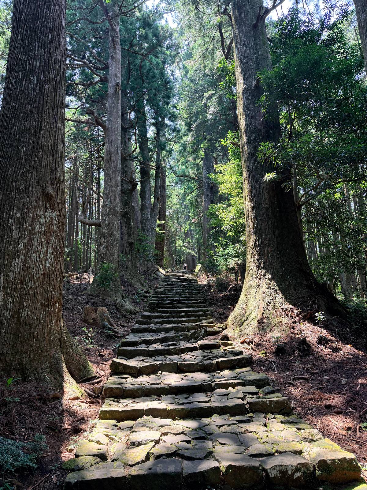
Do not expect a wide, groomed footpath. The UNESCO description of the property says most of the routes are no more than 1 m wide and made of earth, with stone steps or paving in only a few places.9 That narrow, worn path through cedar and cypress is a large part of the appeal, and also the reason good shoes and a slow pace matter on every route.
History
How the pilgrim roads grew
-
10th century
Imperial road
The imperial family starts using the Nakahechi heavily.10
-
11th-13th c.
Royal pilgrimages
Almost 100 imperial pilgrimages from Kyoto.11
-
13th-14th c.
Kohechi
The short way from Koyasan to Hongu takes shape.12
-
15th century
Ohechi
The coastal road is developed for worship and travel.13
-
Late 15th c.
Ant processions
Most pilgrims are now commoners.14
-
July 2004
World Heritage
The routes join the UNESCO list.7
The Nakahechi: the imperial road and the obvious first choice
The Kumano Kodo Nakahechi route starts at Tanabe on the western coast of the Kii Peninsula and runs east into the mountains to the grand shrines; the tourism bureau calls it the most popular route for pilgrims from western Japan.1 From the 10th century, the imperial family used it heavily on pilgrimages from Kyoto.10 It is the main road that links all three Grand Shrines.2
For a first-time visitor it is also the practical choice. The bureau describes the infrastructure as developed, with English signs, maps and luggage shuttle services.15 You can walk it as consecutive days or as short highlight walks between bus stops.16 On foot from Takijiri-oji to Kumano Hongu Taisha is about 38 km, the distance the double pilgrimage programme uses.17
The road goes on beyond Hongu. The mountain sections called the Kogumotori-goe and the Ogumotori-goe link Hongu with Kumano Nachi Taisha, and from Nachi to Hongu on foot is about 30 km.17 The coach day from Osaka sold on this site touches the Nakahechi only at its Nachi end, on the Daimon-zaka steps, so treat it as a taste of the route rather than a walk along it.
The four routes side by side
Nakahechi, Kohechi, Iseji and Ohechi
| Route | From | Length | Time | Good to know |
|---|---|---|---|---|
| Nakahechi | Tanabe | About 38 km to Hongu | 4-day model trek | English signs, luggage shuttles |
| Kohechi | Koyasan | More than 65 km | 4 days | Closed mid-December to mid-March |
| Iseji | Ise | About 170 km | 1 to 2 weeks | Cobblestone passes, trains nearby |
| Ohechi | Tanabe | Sections of 11 to 13 km | Day walks | Some signs in Japanese only |
From the Tanabe City Kumano Tourism Bureau's route pages, model itineraries and course data.171819202142223242515
Ways onto the trail
Three bookable ways to set foot on the routes
This site's day trip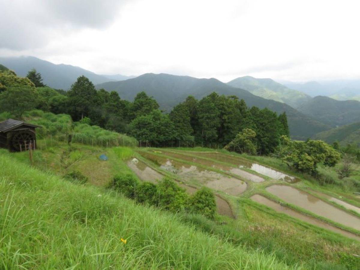 Private walk
 Small group
Most of the routes are no more than 1m wide and of earth; in a few places stone steps or stone pavements were constructed
The Kohechi: high passes between Koyasan and Hongu
The Kumano Kodo Kohechi cuts north to south through the middle of the peninsula, linking the temple town of Koyasan with Kumano Hongu Taisha. It took shape in the 13th and 14th centuries as the shortest way between those sacred sites.12 The tourism bureau's overview page gives three passes above 1000 m and 70 km; its own route page gives four passes above 1000 m and more than 65 km.2619
Plan four days, with nights in Koyasan, Omata, Miura-guchi, Totsukawa Onsen and the Hongu area.20 The bureau's stage table gives about 17 km from Koyasan to Omata, 19 km on to Miura-guchi, 20 km to Totsukawa and 15 km down to Hongu, with walking times of 6.5 to 8 hours that leave out breaks.27 Book the beds first: Miura-guchi has only two places to stay and they fill early.28
This route is not for beginners. The bureau rates it more demanding than the Nakahechi and recommends it to advanced, experienced hikers only.3 It is also seasonal: the Kohechi is technically closed from mid-December to mid-March because the passes can be snow-bound, although the southern Hatenashi-toge section stays open all year.21
Map
The Nakahechi, its shrines and the way in from Osaka
The trail from Takijiri-oji to the three Grand Shrines, the Hongu area with its hot springs, the Nachi sanctuary up close, then the whole peninsula with the stations you arrive at.
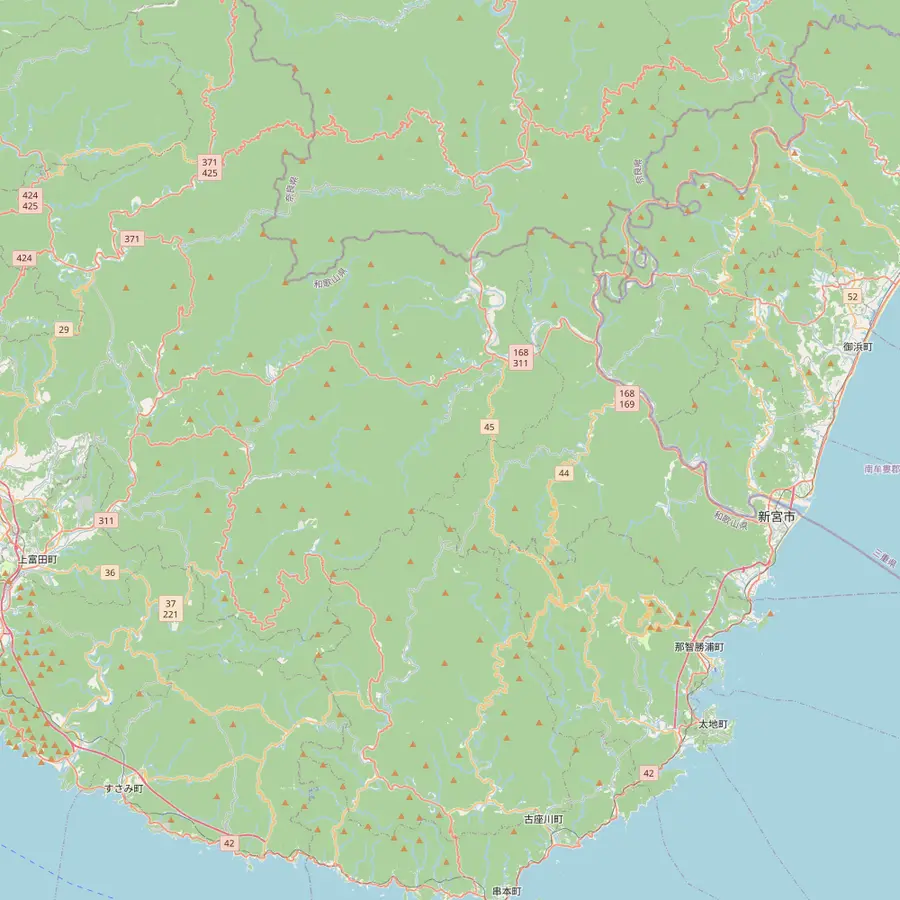 1Takijiri-oji2Takahara3Chikatsuyu-oji4Tsugizakura-oji5Hosshinmon-oji6Kumano Hongu Taisha7Koguchi8Kumano Nachi Taisha9Hayatama Taisha
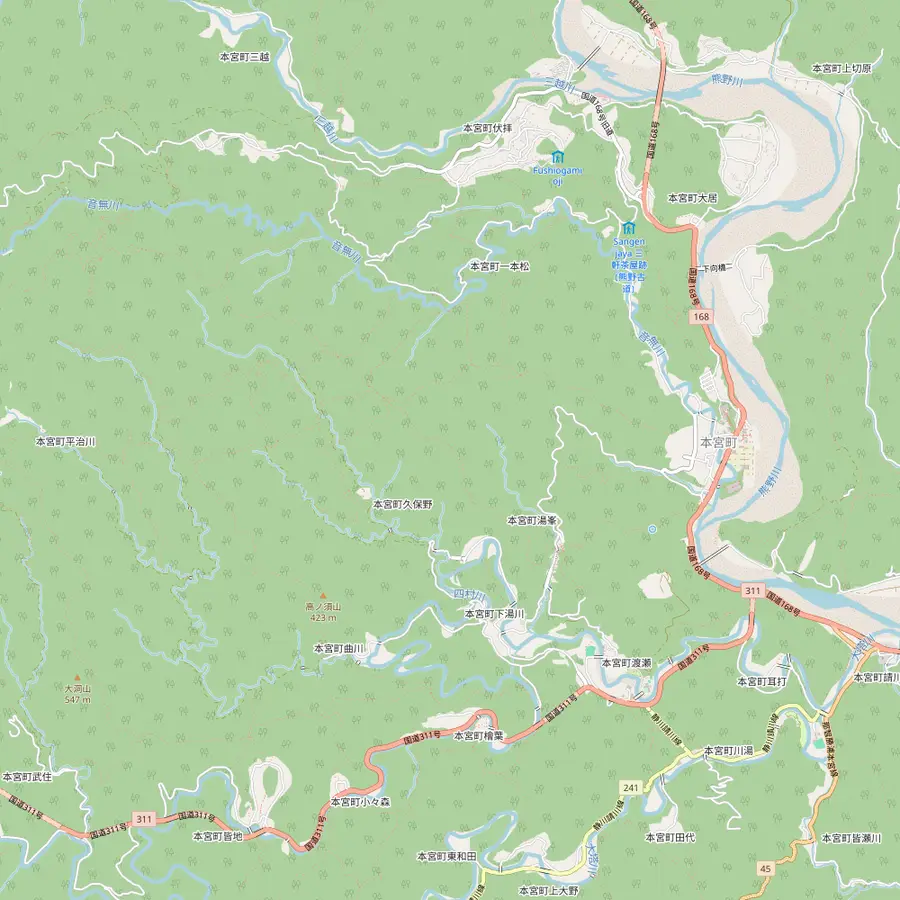 10Fushiogami-oji11Oyunohara12Yunomine Onsen13Wataze Onsen14Kawayu Onsen
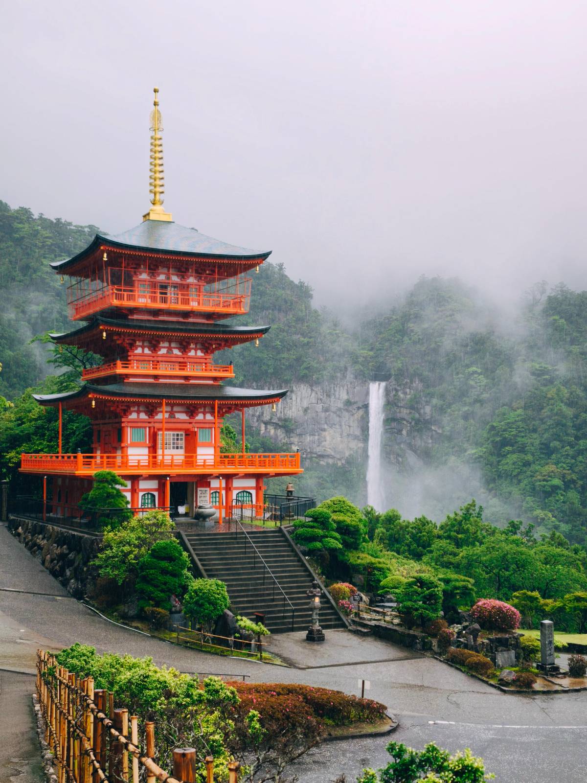
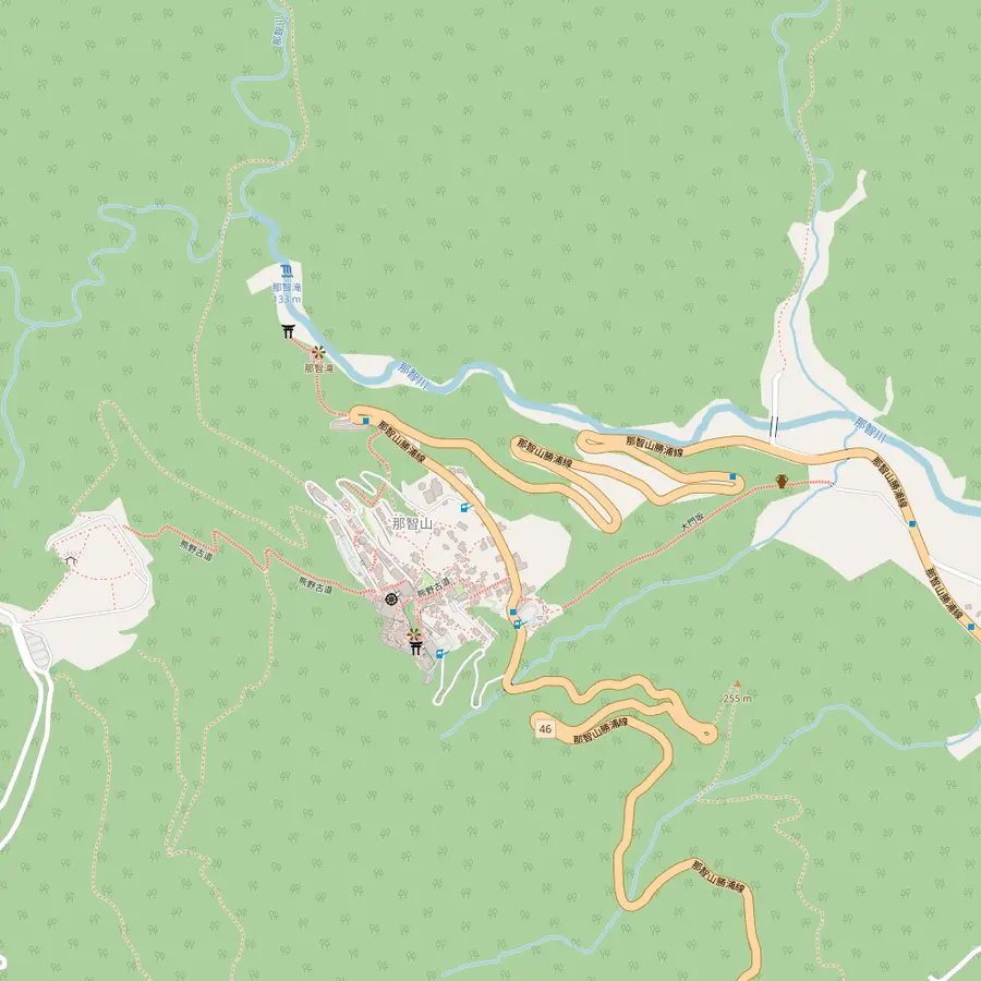 15Daimon-zaka16Seiganto-ji17Nachi Falls (Hiro-jinja)
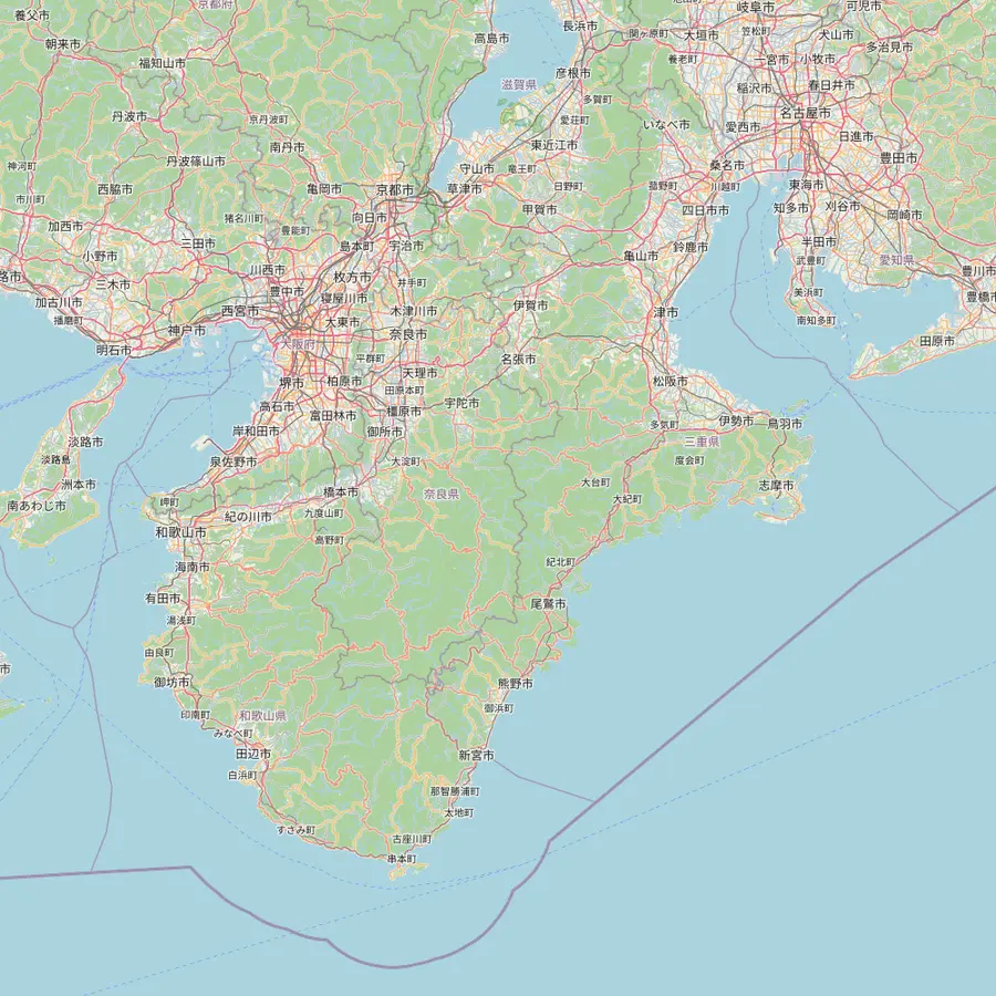 18Osaka (Shinsaibashi)19Kyoto20Koyasan21Kii-Tanabe22Shingu23Kii-Katsuura24Ise
- 1Takijiri-oji
The usual first day of a Nakahechi walk starts here, beside the Kumano Kodo Kan pilgrimage center.2930
In Google Maps ↗ - 2Takahara
A steep climb of about 4 km from Takijiri-oji, through native and planted forest.3132
In Google Maps ↗ - 3Chikatsuyu-oji
An old oji in a basin at about 300 m, at the end of the classic first day; the village has about 450 people.3334
In Google Maps ↗ - 4Tsugizakura-oji
Named for a grafted cherry; some of its cedars are 8 m round and thought to be up to 800 years old.35
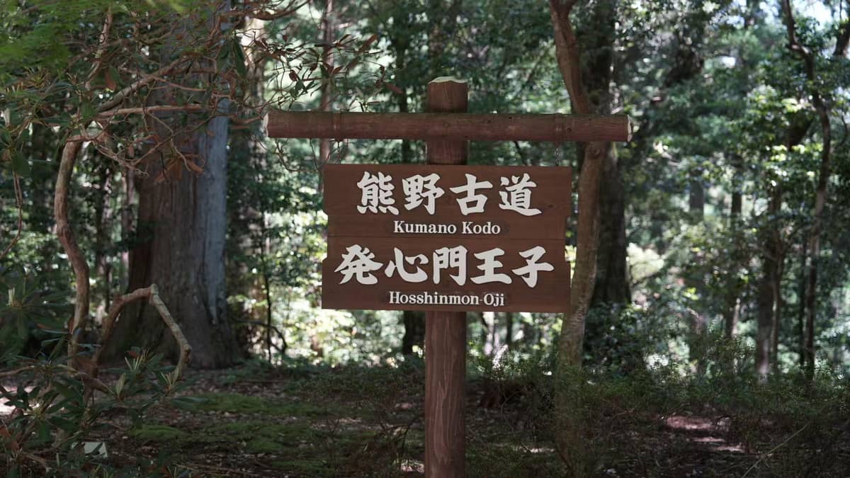
In Google Maps ↗ - 5Hosshinmon-oji
Start of the popular 7 km half-day walk to Kumano Hongu Taisha; there is nowhere to stay here.3637
In Google Maps ↗ - 6Kumano Hongu Taisha
Head shrine of over 3,000 Kumano shrines across Japan; the grounds are free.3839
In Google Maps ↗ - 7Koguchi
Overnight stop between the Kogumotori-goe and the Ogumotori-goe on the way to Nachi.4041
In Google Maps ↗ - 8Kumano Nachi Taisha
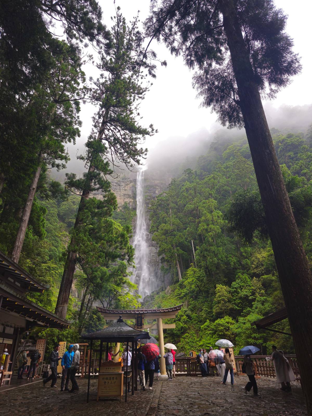
Halfway up Nachi Mountain at about 350 m, about 10 km inland from Katsuura.4243
In Google Maps ↗ - 9Hayatama Taisha
At the mouth of the Kumano-gawa, where the river meets the Pacific.44
In Google Maps ↗ - 10Fushiogami-oji
Where pilgrims fell to their knees at their first sight of the grand shrine.45
In Google Maps ↗ - 11Oyunohara
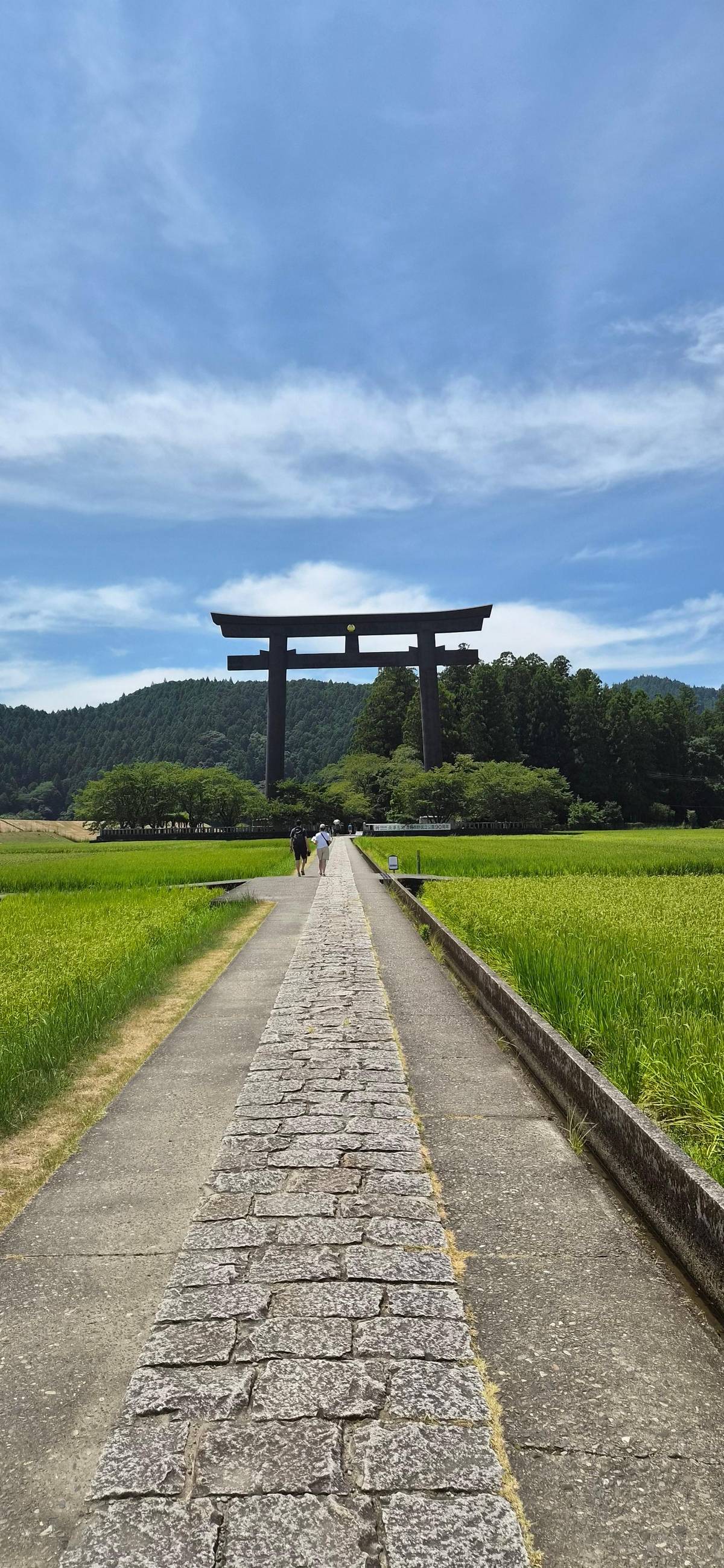
The original shrine site on a sandbank, marked by a steel torii 33.9 m tall.4647
In Google Maps ↗ - 12Yunomine Onsen
A hot spring found about 1,800 years ago, with the Tsuboyu bath.4849
In Google Maps ↗ - 13Wataze Onsen
The largest open-air hot spring bath in western Japan.50
In Google Maps ↗ - 14Kawayu Onsen
Hot water rises through the river bed; in winter a huge river bath is dug.5152
In Google Maps ↗ - 15Daimon-zaka
About 600 m of stone stairs, 267 steps, under old cedars.5354
In Google Maps ↗ - 16Seiganto-ji
A Tendai temple and the first stop of the Saigoku pilgrimage to 33 Kannon.55
In Google Maps ↗ - 17Nachi Falls (Hiro-jinja)
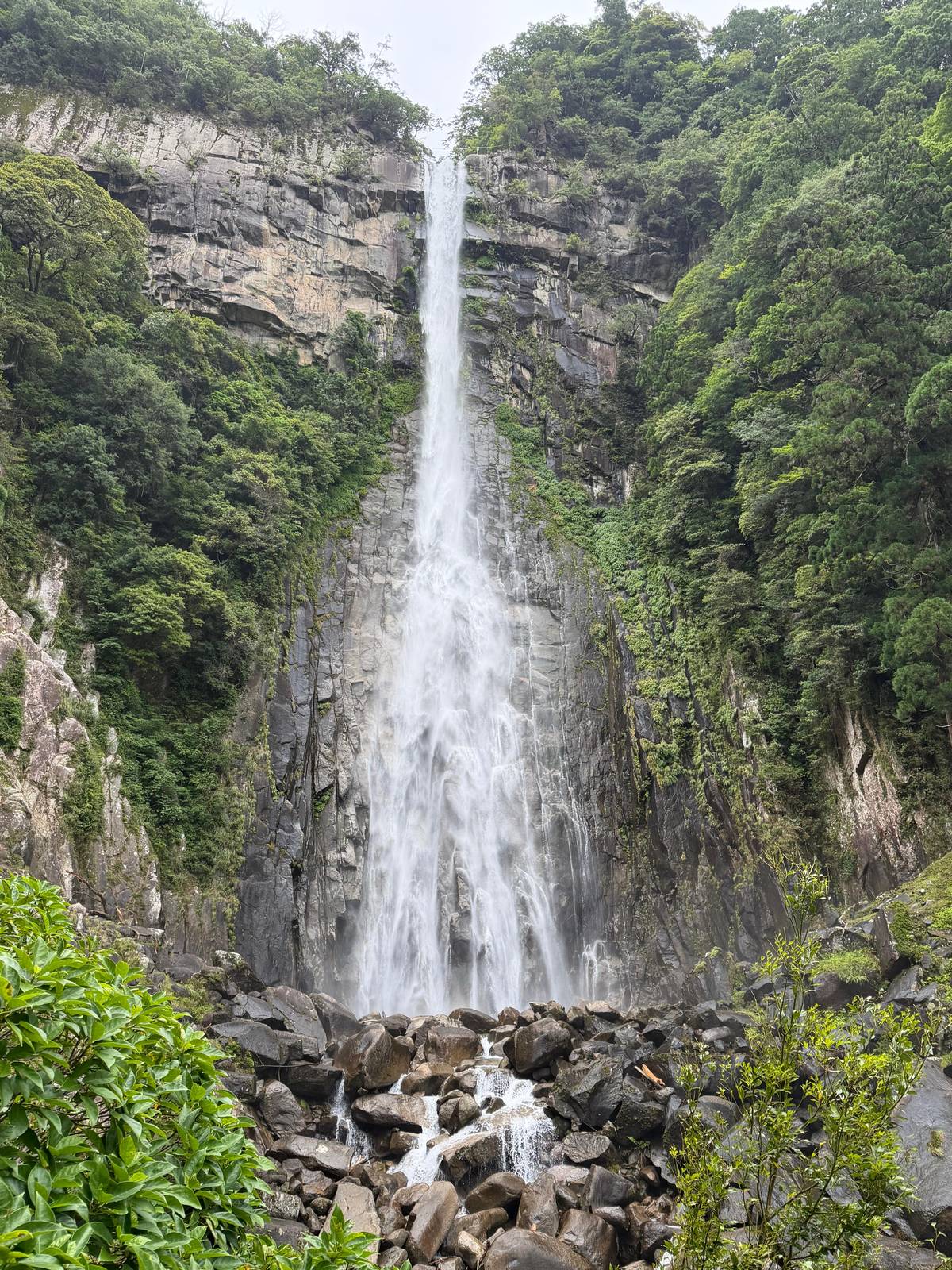
133 m high, worshipped directly with no shrine hall.5657
In Google Maps ↗ - 18Osaka (Shinsaibashi)
The day tour leaves from Q Plaza Shinsaibashi or the National Bunraku Theatre.
In Google Maps ↗ - 19Kyoto
The Kuroshio reaches Kii-Tanabe from Kyoto in 2 hrs 35 min.58
In Google Maps ↗ - 20Koyasan
Start of the Kohechi; reached from Namba on Nankai trains and a cable car.1259
In Google Maps ↗ - 21Kii-Tanabe
Gateway to the Nakahechi; trail buses leave from stop No. 2.160
In Google Maps ↗ - 22Shingu
Home of Hayatama Taisha and a bus hub towards Hongu.4461
In Google Maps ↗ - 23Kii-Katsuura
Buses climb to Nachisan in about 30 minutes.62
In Google Maps ↗ - 24Ise
Start of the Iseji, about 170 km along the east coast.4
In Google Maps ↗
Checklist
Before you pick a route
01
Check
- Kohechi closure from mid-December to mid-March
- The Ohechi closure between Wabuka and Tako
- Beds in Miura-guchi before anything else
02
Plan
- Bus stops that let you shorten a day
- Rain gear for every route
- Walking times that leave out breaks
Cost calculator
Price a guided start for your group
Enter your group size to compare three tours from Osaka.
People
Total from$206
pp from $103
Check availabilityfree cancellationTotals take the cheapest listed price of each Kumano trip on GetYourGuide times your head count, shown in your currency at today's ECB rate; checkout confirms what you actually pay.
Video
KUMANO KODO: Pilgrimage to Japan's Spiritual Origins
The video loads only when you tap play.
The Iseji: cobblestones from Ise down the east coast
The Kumano Kodo Iseji links Ise Jingu with the Kumano Sanzan along the east coast of the peninsula, a trail of about 170 km.4 Walking all of it can take one to two weeks, but the bureau notes that many passes make good day hikes because trailheads often sit near train stations.22
Its signature is stone. To stop heavy rain washing the path away, long sections were paved with cobblestones, so you climb over passes on old stone stairways and drop down to small fishing villages.63 It suits walkers who like a mix of coast and forest and who are happy to string short hikes together by train.
If you are already travelling between Ise and Kumano, one or two passes of the Iseji are an easy addition. As a first long walk in Kumano it asks more planning than the Nakahechi, simply because it is long and runs through another region, Mie, where you arrange your own transport between sections.
The Ohechi: the coastal road south of Tanabe
The Ohechi leaves Tanabe and runs south along the coast to Fudarakusan-ji Temple near Nachi.5 It was developed in the 15th century and served both worship and sightseeing.13 Its passes are shorter than the mountain routes: the Tonda-zaka section is about 13 km and 4 to 5 hours, the Nagai-zaka about 11 km and 3 to 4 hours.2324
Two practical points before you choose it. Signage varies and some sections only carry Japanese signs.25 And part of the route between Wabuka and Tako stations is closed from 8 June 2026 to 30 April 2027, an estimated date, for highway construction, so you skip that stretch by train or bus.64
The Ohechi rewards walkers who want quiet coast, sea views from the passes and short days linked by the coastal railway. It is a good second trip after the Nakahechi, or a fit for someone who wants the pilgrimage feeling without long mountain climbs.
How the routes came to be walked by so many
Kumano drew emperors long before it drew hikers. From the 11th to the 13th centuries, the imperial family from Kyoto made the pilgrimage almost 100 times.11 By the late 15th century, the bureau writes, most pilgrims were commoners, and so many came that people spoke of ant processions.14
Along the way stood small subsidiary shrines called oji, known together as the Ninety-nine Oji, a figure meant as many rather than as an exact count.65 Kumano Hongu Taisha itself describes pilgrims travelling 300 km from Kyoto on these roads.66 Kumano also stood out for welcoming everyone: the bureau notes that it accepted pilgrims regardless of sect, class or gender, where other sacred sites barred women.67
That history explains why the routes look the way they do today. Oji shrines, stone markers and old teahouse sites line the Nakahechi in particular, and each of them is a natural rest stop. Knowing that you are walking a road worn by centuries of feet makes the steep sections easier to forgive.
Which route to choose for your trip
For most first visits the answer is the Nakahechi, walked from Takijiri-oji to Hongu and, with more days, on to Nachi. It has the signs, the inns, the buses and the luggage shuttles that make a self-guided walk realistic.15 If your stay is short, the classic half-day section from Hosshinmon-oji into Hongu gives you the essence of it in about 7 km.36
Choose the Kohechi only with real hiking experience and a booking at every village, and keep it out of the winter months.213 Choose the Iseji if you want coast, cobblestones and a long journey, and the Ohechi if you want short coastal passes from Tanabe. All of them ask for respect for the weather: the bureau warns that the area receives lots of rain.68
If you only have one free day in Osaka, walking any route properly is out of reach. That is where a coach day trip makes sense: it brings you to all three Grand Shrines and onto the Daimon-zaka steps at Nachi in one long day, from $103. It is sightseeing with a short walk, and this site never pretends otherwise.
Your day in Kumano
Three shrines and the cedar steps in one day.
Pick a date, meet in central Osaka, and cancel free up to 24 hours before.


You ask,we answer.
How many routes make up the Kumano Kodo?
Nakahechi, Kohechi, Ohechi, Iseji. The Nakahechi, Kohechi, Ohechi and Iseji all lead to the Kumano Grand Shrines.126569
Which route is best for beginners?
The Nakahechi. It has English signs, maps and luggage shuttles, and can be split into short walks.1516
How long is the Iseji?
About 170 km. Walking all of it can take one to two weeks, though many passes work as day hikes from stations.422
Can I walk the Kohechi in winter?
Not between mid-December and mid-March. It is technically closed then; only the Hatenashi-toge section stays open.21
How many days does the Kohechi take?
Four days. With nights in Koyasan, Omata, Miura-guchi, Totsukawa Onsen and the Hongu area.20
Is the Ohechi open in 2026?
Mostly, with one closed stretch. Between Wabuka and Tako stations it is closed from 8 June 2026 to 30 April 2027, estimated.64
When did the routes become World Heritage?
In July 2004. As part of the Sacred Sites and Pilgrimage Routes in the Kii Mountain Range.7
Sources
Sources and evidence
- 1Tanabe City Kumano Tourism BureauKumano Kodo↩
- 2Tanabe City Kumano Tourism BureauNakahechi↩
- 3Tanabe City Kumano Tourism BureauKohechi↩
- 4Tanabe City Kumano Tourism BureauIseji↩
- 5Tanabe City Kumano Tourism BureauKumano Kodo↩
- 6Tanabe City Kumano Tourism BureauKumano Kodo↩
- 7Tanabe City Kumano Tourism BureauKumano Kodo↩
- 8Tanabe City Kumano Tourism BureauWorld Heritage: Sacred Sites and Pilgrimage Routes in the Kii Mountain Range (with the UNESCO descriptions)↩
- 9Tanabe City Kumano Tourism BureauWorld Heritage: Sacred Sites and Pilgrimage Routes in the Kii Mountain Range (with the UNESCO descriptions)↩
- 10Tanabe City Kumano Tourism BureauKumano Kodo↩
- 11Tanabe City Kumano Tourism BureauHistory & Oji↩
- 12Tanabe City Kumano Tourism BureauKohechi↩
- 13Tanabe City Kumano Tourism BureauOhechi↩
- 14Tanabe City Kumano Tourism BureauWorld Heritage: Sacred Sites and Pilgrimage Routes in the Kii Mountain Range (with the UNESCO descriptions)↩
- 15Tanabe City Kumano Tourism BureauNakahechi↩
- 16Tanabe City Kumano Tourism BureauNakahechi↩
- 17Tanabe City Kumano Tourism BureauDual Pilgrim↩
- 18Tanabe City Kumano Tourism BureauModel Itineraries↩
- 19Tanabe City Kumano Tourism BureauKohechi↩
- 20Tanabe City Kumano Tourism BureauKohechi↩
- 21Tanabe City Kumano Tourism BureauKohechi↩
- 22Tanabe City Kumano Tourism BureauIseji↩
- 23Tanabe City Kumano Tourism BureauTonda-zaka↩
- 24Tanabe City Kumano Tourism BureauNagai-zaka↩
- 25Tanabe City Kumano Tourism BureauOhechi↩
- 26Tanabe City Kumano Tourism BureauKumano Kodo↩
- 27Tanabe City Kumano Tourism BureauDifficulty Rating↩
- 28Tanabe City Kumano Tourism BureauKohechi↩
- 29Tanabe City Kumano Tourism BureauTakijiri-oji to Tsugizakura-oji↩
- 30Tanabe City Kumano Tourism BureauTakijiri-oji to Tsugizakura-oji↩
- 31Tanabe City Kumano Tourism BureauTakijiri-oji to Takahara↩
- 32Tanabe City Kumano Tourism BureauTakijiri-oji to Takahara↩
- 33Tanabe City Kumano Tourism BureauHistory & Oji↩
- 34Tanabe City Kumano Tourism BureauChikatsuyu↩
- 35Tanabe City Kumano Tourism BureauHistory & Oji↩
- 36Tanabe City Kumano Tourism BureauTsugizakura-oji to Kumano Hongu Taisha↩
- 37Tanabe City Kumano Tourism BureauHosshinmon-oji to Kumano Hongu Taisha↩
- 38Tanabe City Kumano Tourism BureauKumano Hongu Taisha↩
- 39Tanabe City Kumano Tourism BureauKumano Hongu Taisha↩
- 40Tanabe City Kumano Tourism BureauSuggested Walks↩
- 41Tanabe City Kumano Tourism BureauSuggested Walks↩
- 42Tanabe City Kumano Tourism BureauKumano Nachi Taisha↩
- 43Tanabe City Kumano Tourism BureauKumano Nachi Taisha↩
- 44Tanabe City Kumano Tourism BureauKumano Hayatama Taisha↩
- 45Tanabe City Kumano Tourism BureauHosshinmon-oji to Kumano Hongu Taisha↩
- 46Tanabe City Kumano Tourism BureauKumano Hongu Taisha↩
- 47Tanabe City Kumano Tourism BureauKumano Hongu Taisha↩
- 48Tanabe City Kumano Tourism BureauYunomine Onsen↩
- 49Tanabe City Kumano Tourism BureauYunomine Onsen↩
- 50Tanabe City Kumano Tourism BureauWataze/Watarase Onsen↩
- 51Tanabe City Kumano Tourism BureauKawayu Onsen↩
- 52Tanabe City Kumano Tourism BureauKawayu Onsen↩
- 53Tanabe City Kumano Tourism BureauDaimon-zaka↩
- 54Tanabe City Kumano Tourism BureauDaimon-zaka↩
- 55Tanabe City Kumano Tourism BureauKumano Nachi Taisha↩
- 56Tanabe City Kumano Tourism BureauKumano Nachi Taisha↩
- 57Kumano Nachi Taisha飛瀧神社(那智御瀧) (Hiro-jinja, Nachi Falls)↩
- 58Tanabe City Kumano Tourism BureauTransport: Train↩
- 59Tanabe City Kumano Tourism BureauTransport: Train↩
- 60Tanabe City Kumano Tourism BureauTanabe↩
- 61Tanabe City Kumano Tourism BureauTransport: Bus↩
- 62Kumano Nachi Taishaアクセス (Access)↩
- 63Tanabe City Kumano Tourism BureauKumano Kodo↩
- 64Tanabe City Kumano Tourism BureauKumano Kodo Tips & Safety↩
- 65Tanabe City Kumano Tourism BureauHistory & Oji↩
- 66Kumano Hongu TaishaEnglish - Kumano Hongu Taisha↩
- 67Tanabe City Kumano Tourism BureauHistory & Oji↩
- 68Tanabe City Kumano Tourism BureauSuggested Walks↩
- 69Tanabe City Kumano Tourism BureauKumano Kodo↩