 This site's day trip
Guides
Language
EnglishCurrency
US dollar · $Your currency applies on GetYourGuide too.
Guide · Nachisan
Daimonzaka trail to Nachi Falls, step by step
The Daimonzaka trail is the most famous short walk in Kumano: worn stone stairs through giant cedars up to Kumano Nachi Taisha, a vermilion pagoda and Japan's tallest waterfall.
Check availabilityfrom $103 · cancellation is free
Editorial team, kumanokodohike.comUpdated October 22, 20266 minutes to read60 sources
Quick answer
A stone stairway into the Nachi sanctuary
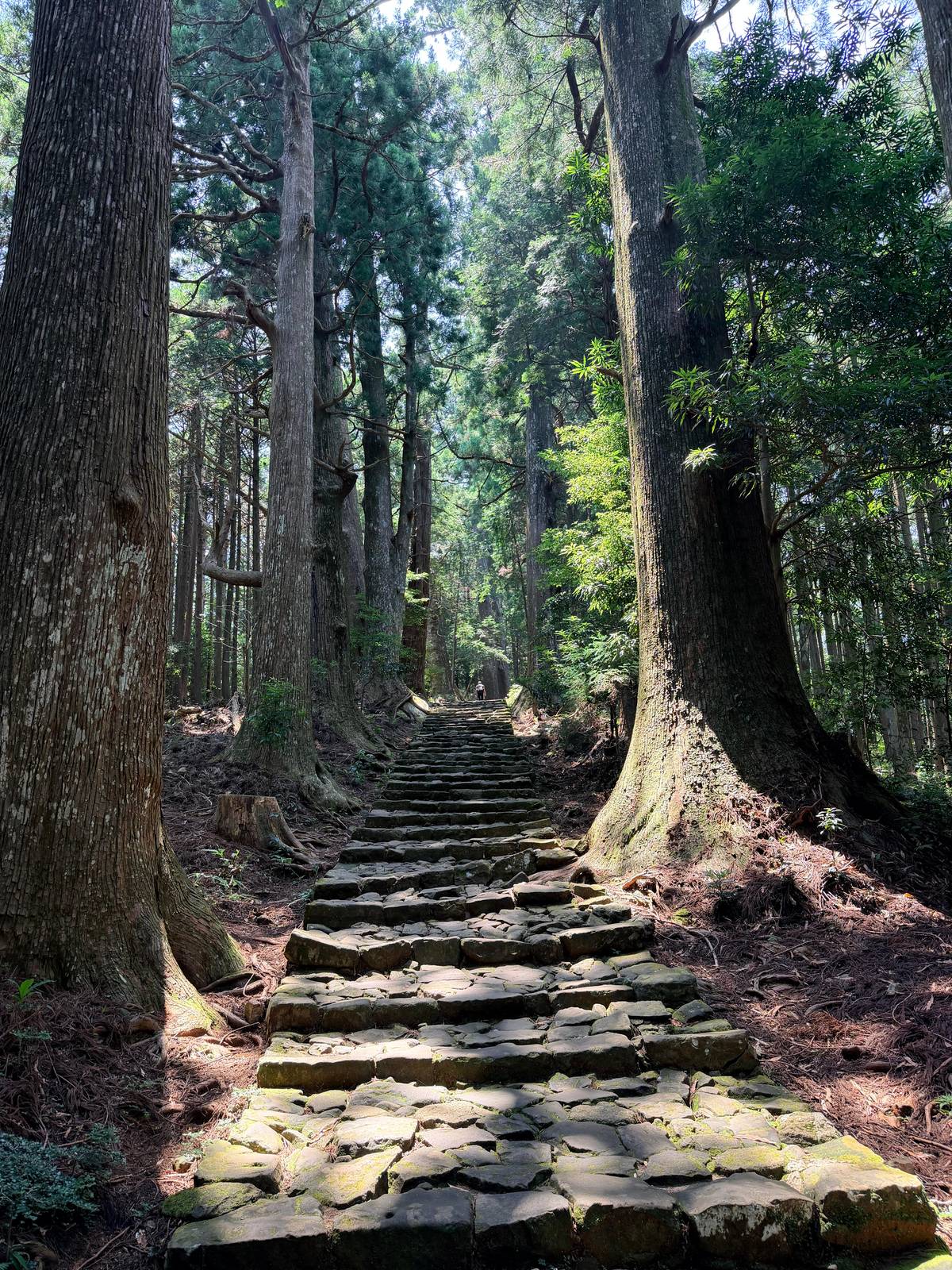
Daimon-zaka is a cobblestone staircase slope that climbs from the valley floor to Kumano Nachi Taisha, Seiganto-ji Temple and the Nachi waterfall.7 It is part of the Nakahechi, the last stretch of the old pilgrim road before the sanctuary, and one of the easiest pieces of the Kumano Kodo to reach by bus from the coast.
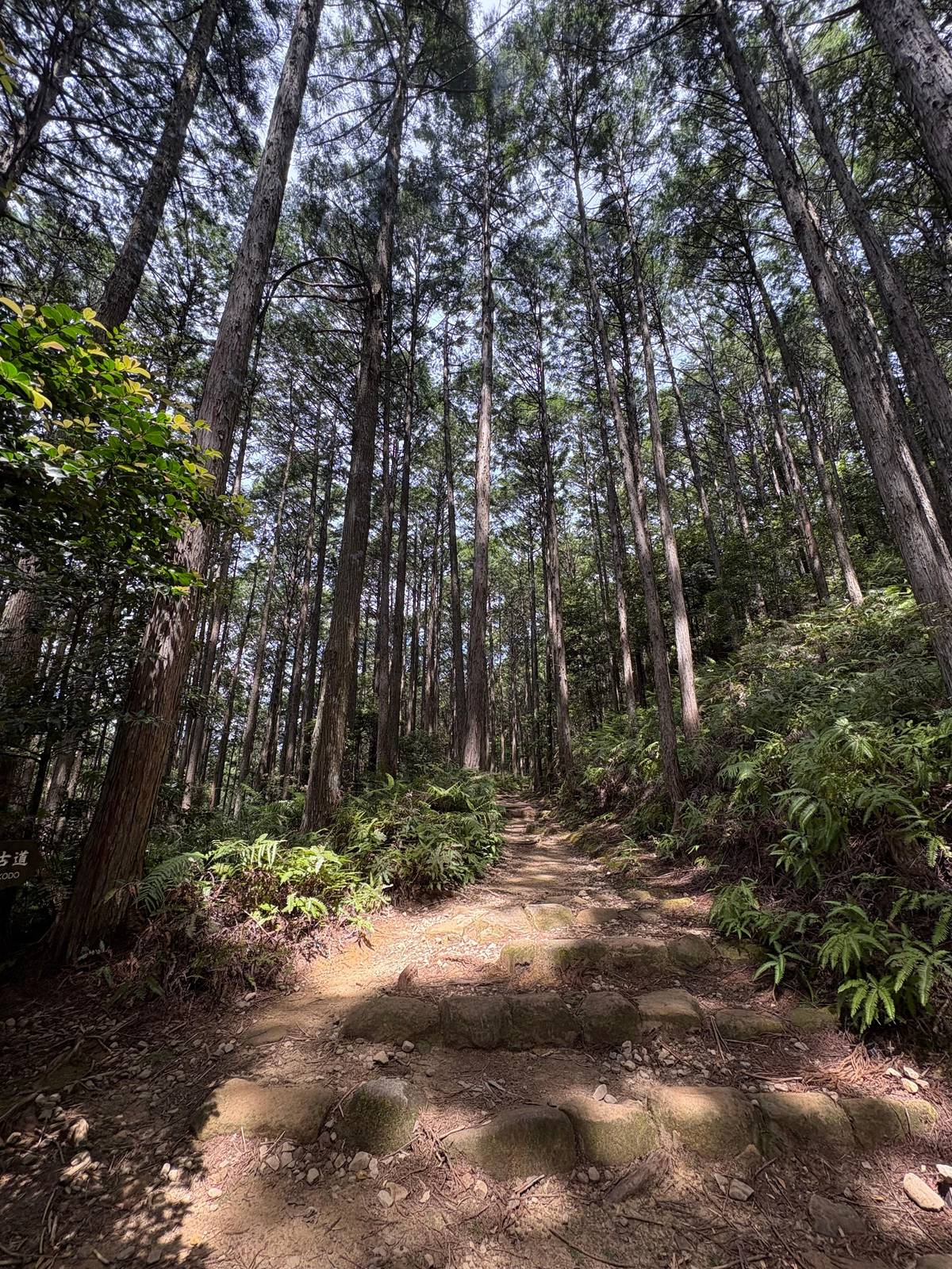
The name means large gate slope, after a gate that once stood nearby.8 What you see today are centuries-old Japanese cedars, cypress, camphor trees and bamboo groves lining the stairs.9 In rain the moss glows and mist hangs between the trunks; on a dry morning the light comes through in long beams. Both are worth the climb.
This is also the walk on the coach day trip from Osaka sold on this site. Its listing gives 20 to 40 minutes on the Daimon-zaka pilgrim route as part of the Nachi stop, together with the shrine, Seiganto-ji and the Hiro shrine at the falls. For many visitors it is their only time on the trail, and it is a good one.
The walk in order
From the bus stop to the falls
-
Start
Daimonzaka bus stop
Toilets, vending machines and sticks to borrow.10
-
Foot of the slope
Meoto-sugi cedars
Husband-and-wife cedars with roots entwined under the path.11
-
The climb
267 stone steps
About 600 m of staircase under old trees.1
-
Near the top
First view of the falls
The fall appears through the forest.12
-
Shrine area
Nachi Taisha, Seiganto-ji
About 20 more minutes of stairs.3
-
Finish
Nachi Falls
Distance, time and how hard it really is
The staircase itself is about 600 m long with 267 steps.1 The tourism bureau counts the slope as about 1 km and about 30 minutes, rated 1.5 on its scale of 5, and adds that the walk grows longer once you visit the shrines and the falls.2 From the top of the slope it is another 20 minutes of stairs to the shrine complex.3
Those times leave out breaks and assume a healthy walker without a pack in good weather.2 Most people stop often, for photos and for breath, so allow an hour from the bus stop to the shrine and do not rush. The steps are uneven, some are high, and handrails are few.
The real hazard is the surface. The bureau warns that most injuries on the Kumano Kodo are slips and falls on stone and roots, and that old cobbles are especially slippery when wet.14 Wear shoes with grip, keep your hands free, and take the descent more slowly than the climb.
What is where
The Nachi sanctuary at a glance
| Place | What it is | Cost or hours |
|---|---|---|
| Daimon-zaka | Stone stairs under old cedars | Free |
| Kumano Nachi Taisha | Grand Shrine at about 350 m | Free, office 6:00 to 16:30 |
| Seiganto-ji | Temple with the vermilion pagoda | First of the 33 Saigoku temples |
| Hiro-jinja | Shrine at the foot of the falls | No main hall |
| Falls stage | Closest view of the water | 500 yen adults, 200 yen pupils |
From the Tanabe City Kumano Tourism Bureau and Kumano Nachi Taisha, as read in October 2026.7161718619
Ways to walk it
Three bookable visits to Daimon-zaka and Nachi
This site's day trip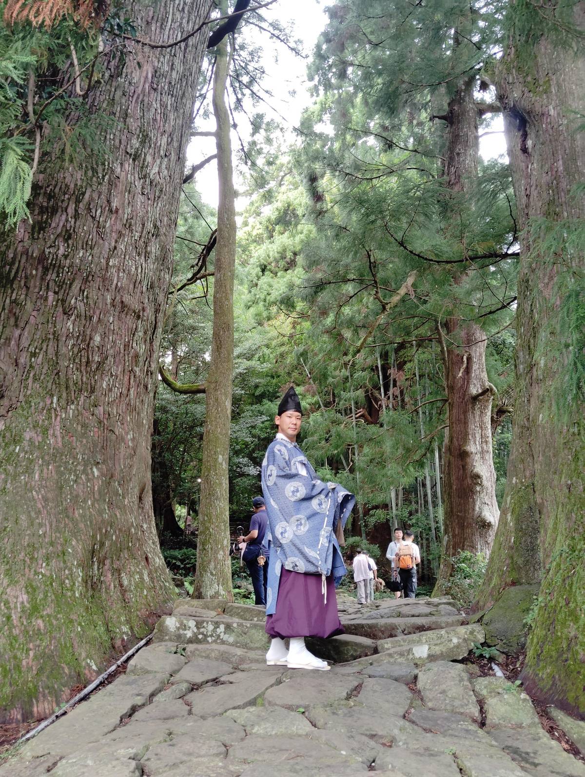 Private walk
Walk in Heian attire
Daimon-zaka to Nachi
- Time
- 2 to 4 hours
- Start
- Nachi Station
- Price
- from $96
 Shortest option
Shrine, temple, falls
Guided on Nachisan
- Time
- 1.5 to 2 hours
- Start
- Nachi Station
- Price
- from $56
Decision helper
How should you do Daimon-zaka?
Choose the line that sounds like your trip
The coach day trip
Nachi, Hongu and Hayatama with entry fees included.
The local bus
Kii-Katsuura to the foot of the slope in 20 minutes.4
Heian attire walk
A guided walk up the stairs in period dress.
Bus up, walk down
The bus also climbs to Nachisan in about 30 minutes.15
A short guided visit
Shrine, temple and falls with an English guide.
Daimon-zaka is an impressive cobblestone staircase slope which runs from the base of the valley to Kumano Nachi Taisha, Seiganto-ji Temple and Nachi waterfall.
What you pass on the way up
At the foot of the slope stand the Meoto-sugi, the husband-and-wife cedars whose roots are entwined beneath the path.11 Close by, Daimon-zaka-chaya rents kimonos in the style of the Heian period, popular for photos on the stairs.20 The Daimon-zaka parking lot bus stop has toilets, vending machines and walking sticks you can borrow.10
The climb itself is quiet. Stone lanterns, moss and the trunks of old trees frame almost every step, and in the upper part the view opens briefly through the forest. Near the top of the slope you catch your first glimpse of the Nachi falls, a white line on the mountain ahead.12
From there the stairs continue to the shrine area, past souvenir shops and small restaurants. If you want to see the slope in costume with a guide, one listing offers a walk up Daimon-zaka with a Heian attire option, priced from $96. Its record notes that the clothing may not be available in bad weather.
Map
The Nakahechi, its shrines and the way in from Osaka
The trail from Takijiri-oji to the three Grand Shrines, the Hongu area with its hot springs, the Nachi sanctuary up close, then the whole peninsula with the stations you arrive at.
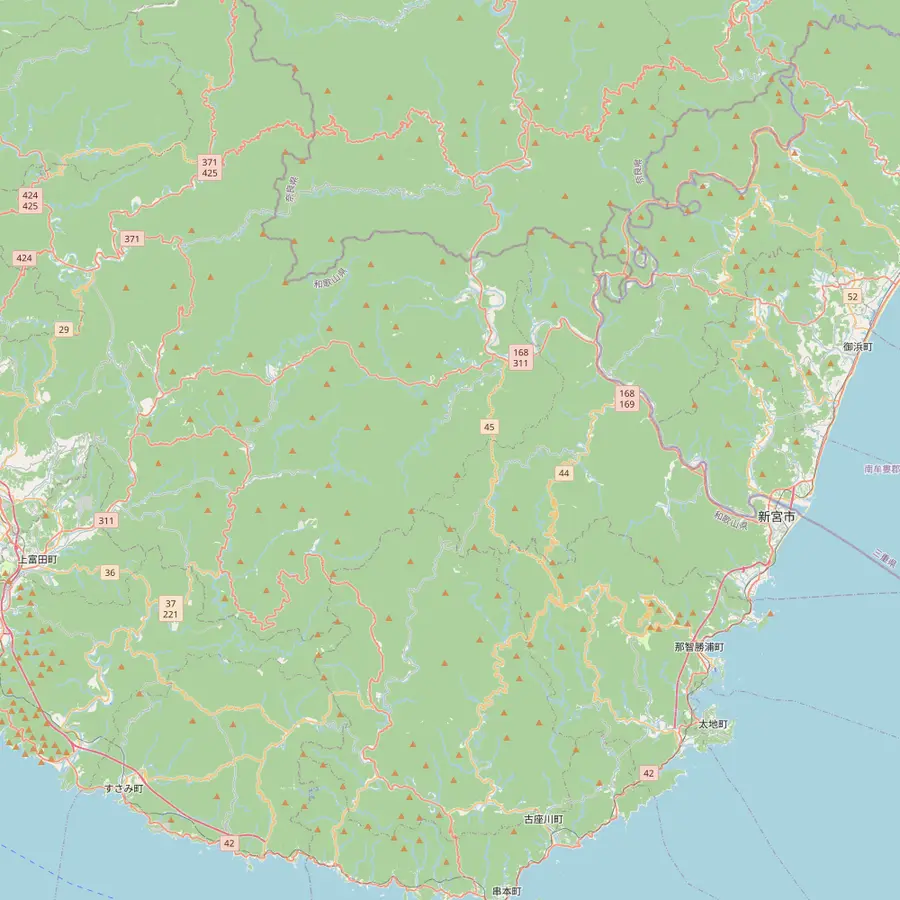 1Takijiri-oji2Takahara3Chikatsuyu-oji4Tsugizakura-oji5Hosshinmon-oji6Kumano Hongu Taisha7Koguchi8Kumano Nachi Taisha9Hayatama Taisha
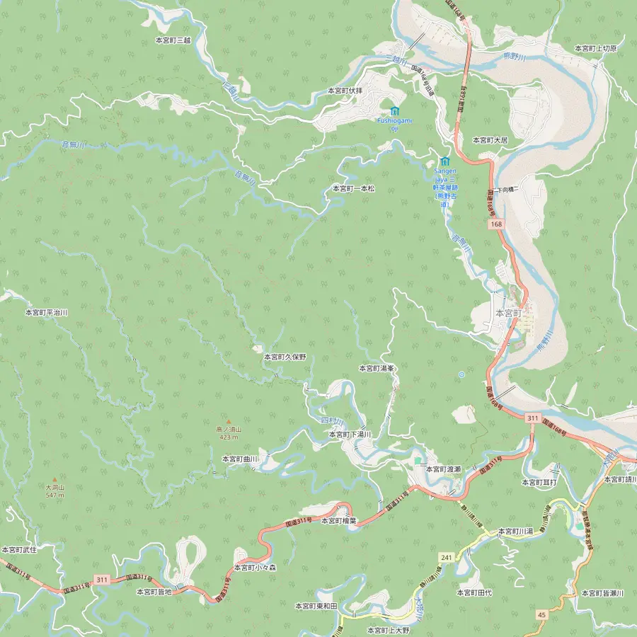 10Fushiogami-oji11Oyunohara12Yunomine Onsen13Wataze Onsen14Kawayu Onsen
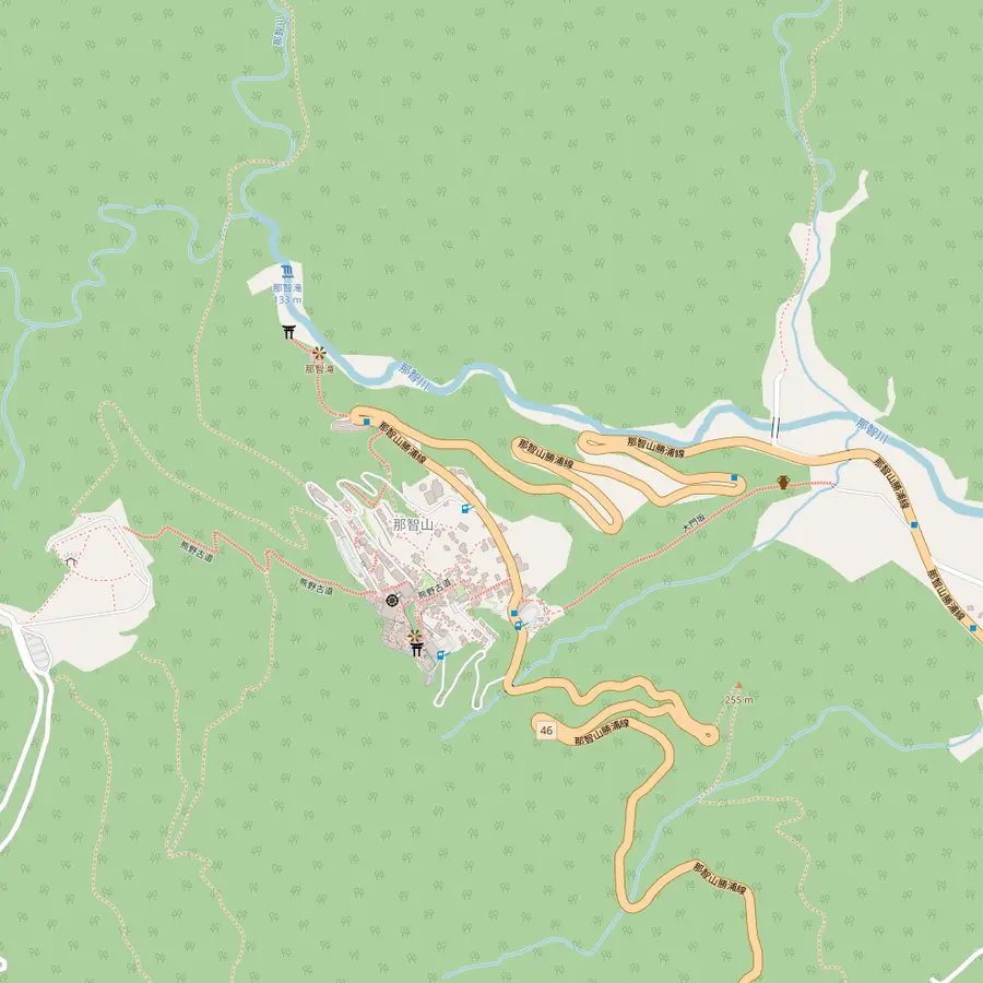 15Daimon-zaka16Seiganto-ji17Nachi Falls (Hiro-jinja)
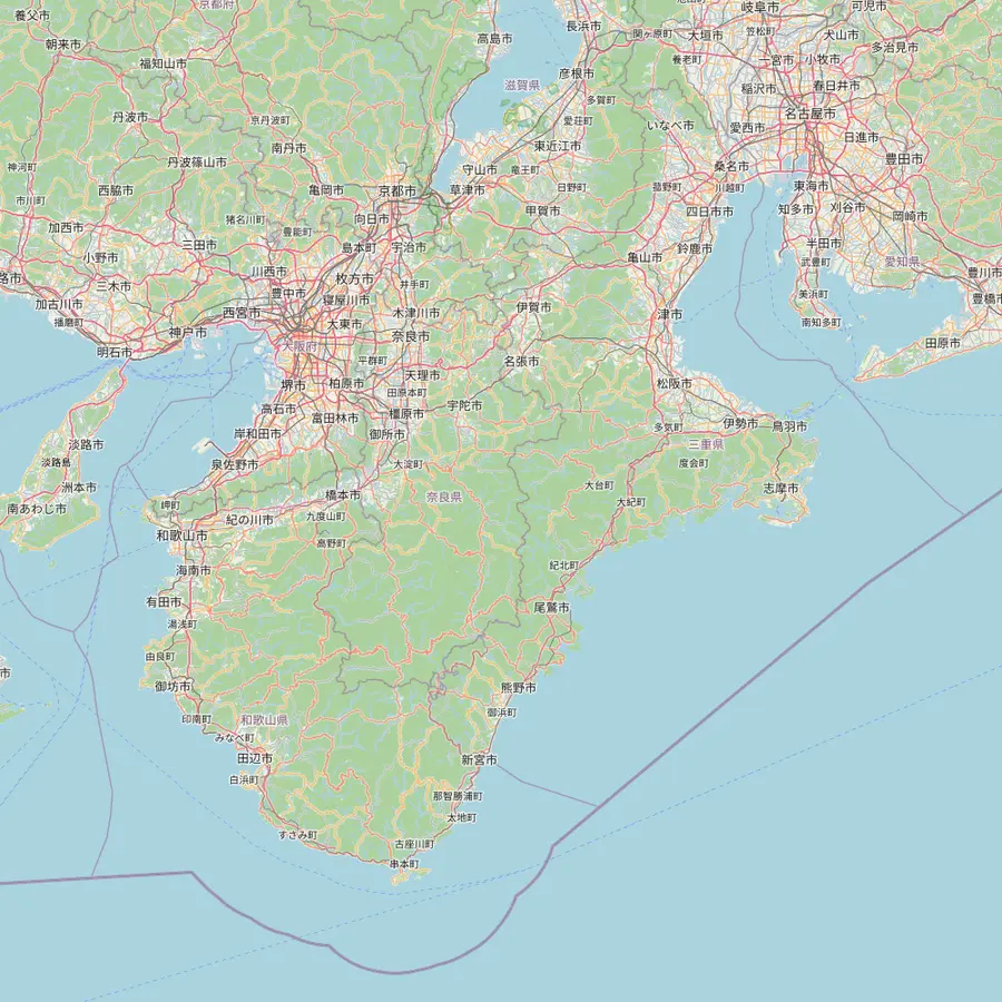 18Osaka (Shinsaibashi)19Kyoto20Koyasan21Kii-Tanabe22Shingu23Kii-Katsuura24Ise
- 1Takijiri-oji
The usual first day of a Nakahechi walk starts here, beside the Kumano Kodo Kan pilgrimage center.2122
In Google Maps ↗ - 2Takahara
A steep climb of about 4 km from Takijiri-oji, through native and planted forest.2324
In Google Maps ↗ - 3Chikatsuyu-oji
An old oji in a basin at about 300 m, at the end of the classic first day; the village has about 450 people.2526
In Google Maps ↗ - 4Tsugizakura-oji
Named for a grafted cherry; some of its cedars are 8 m round and thought to be up to 800 years old.27
In Google Maps ↗ - 5Hosshinmon-oji
Start of the popular 7 km half-day walk to Kumano Hongu Taisha; there is nowhere to stay here.2829
In Google Maps ↗ - 6Kumano Hongu Taisha
Head shrine of over 3,000 Kumano shrines across Japan; the grounds are free.3031
In Google Maps ↗ - 7Koguchi
Overnight stop between the Kogumotori-goe and the Ogumotori-goe on the way to Nachi.3233
In Google Maps ↗ - 8Kumano Nachi Taisha
Halfway up Nachi Mountain at about 350 m, about 10 km inland from Katsuura.1634
In Google Maps ↗ - 9Hayatama Taisha
At the mouth of the Kumano-gawa, where the river meets the Pacific.35
In Google Maps ↗ - 10Fushiogami-oji
Where pilgrims fell to their knees at their first sight of the grand shrine.36
In Google Maps ↗ - 11Oyunohara
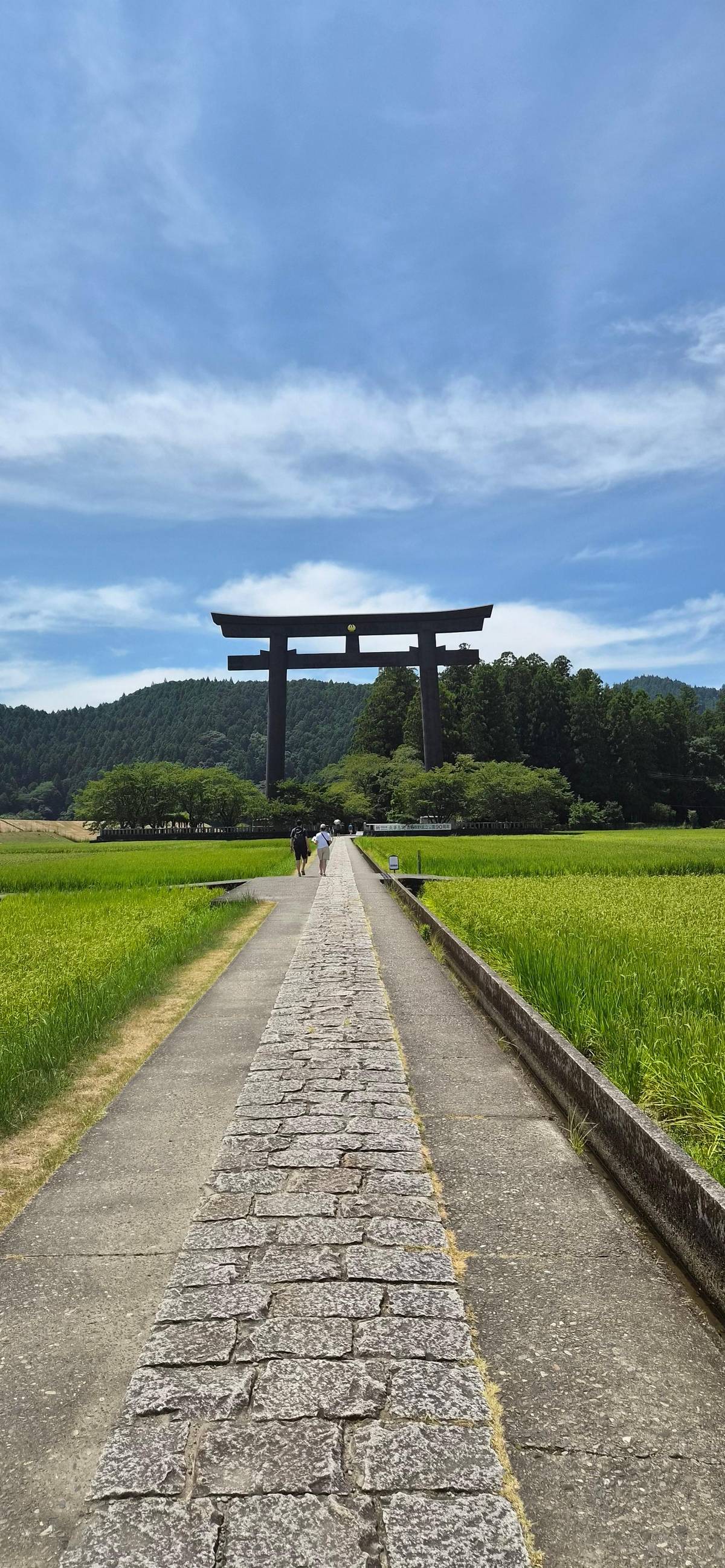
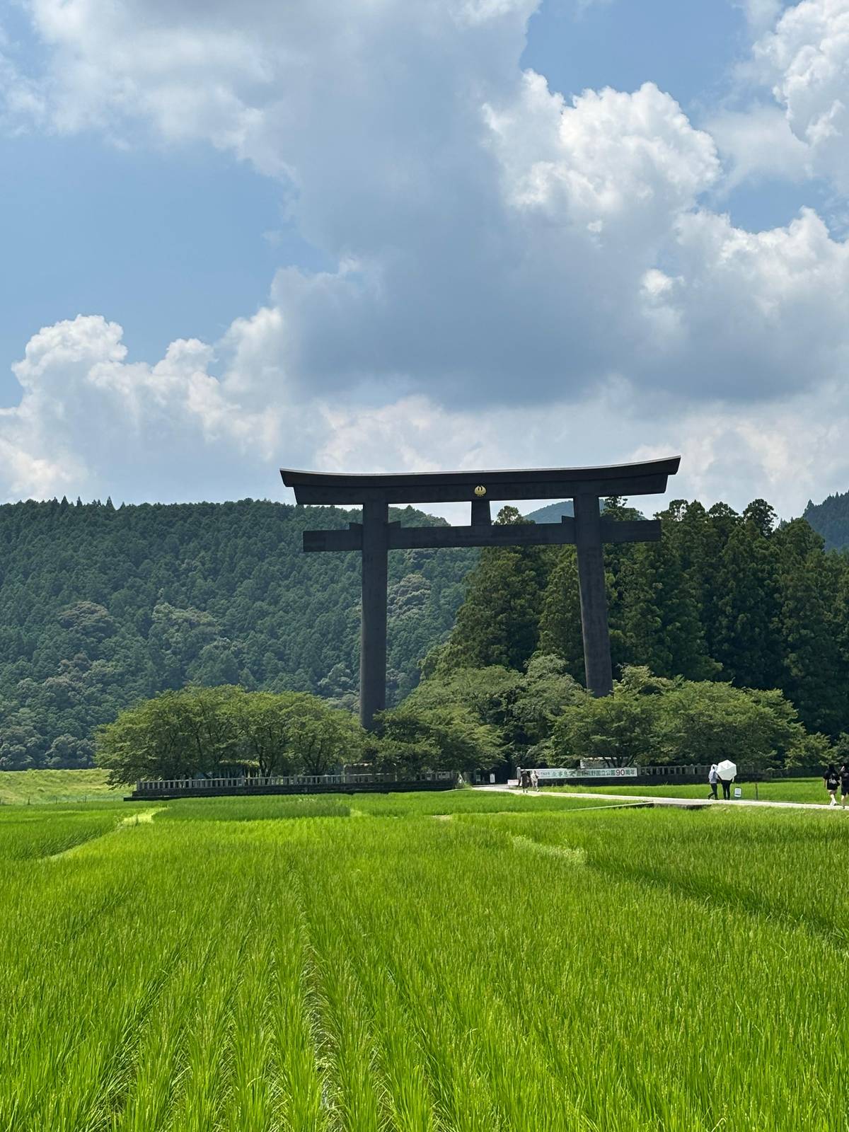
The original shrine site on a sandbank, marked by a steel torii 33.9 m tall.3738
In Google Maps ↗ - 12Yunomine Onsen
A hot spring found about 1,800 years ago, with the Tsuboyu bath.3940
In Google Maps ↗ - 13Wataze Onsen
The largest open-air hot spring bath in western Japan.41
In Google Maps ↗ - 14Kawayu Onsen
Hot water rises through the river bed; in winter a huge river bath is dug.4243
In Google Maps ↗ - 15Daimon-zaka
About 600 m of stone stairs, 267 steps, under old cedars.19
In Google Maps ↗ - 16Seiganto-ji
A Tendai temple and the first stop of the Saigoku pilgrimage to 33 Kannon.18
In Google Maps ↗ - 17Nachi Falls (Hiro-jinja)
133 m high, worshipped directly with no shrine hall.56
In Google Maps ↗ - 18Osaka (Shinsaibashi)
The day tour leaves from Q Plaza Shinsaibashi or the National Bunraku Theatre.
In Google Maps ↗ - 19Kyoto
The Kuroshio reaches Kii-Tanabe from Kyoto in 2 hrs 35 min.44
In Google Maps ↗ - 20Koyasan
Start of the Kohechi; reached from Namba on Nankai trains and a cable car.4546
In Google Maps ↗ - 21Kii-Tanabe
Gateway to the Nakahechi; trail buses leave from stop No. 2.4748
In Google Maps ↗ - 22Shingu
Home of Hayatama Taisha and a bus hub towards Hongu.3549
In Google Maps ↗ - 23Kii-Katsuura
Buses climb to Nachisan in about 30 minutes.15
In Google Maps ↗ - 24Ise
Start of the Iseji, about 170 km along the east coast.50
In Google Maps ↗
Checklist
Before the climb
01
Bring
- Shoes with grip for wet stone
- Rain gear or an umbrella
- Coins for the falls stage
02
Know
- Allow an hour from bus to shrine
- Buses from Kii-Katsuura via Nachi Station
- Many steps and few handrails
Video
【4K Japan Walk】Kumano Kodo you can feel the mysterious atmosphere from Daimonzaka to Nachi Falls
The video loads only when you tap play.
Kumano Nachi Taisha and Seiganto-ji at the top
Kumano Nachi Taisha stands halfway up Nachi Mountain, at about 350 m above sea level.16 It grew out of the ancient worship of the waterfall, and it is one of the three Grand Shrines of Kumano.51 The grounds are free to enter and the shrine office is open from 6:00 to 16:30.17
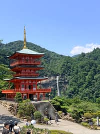
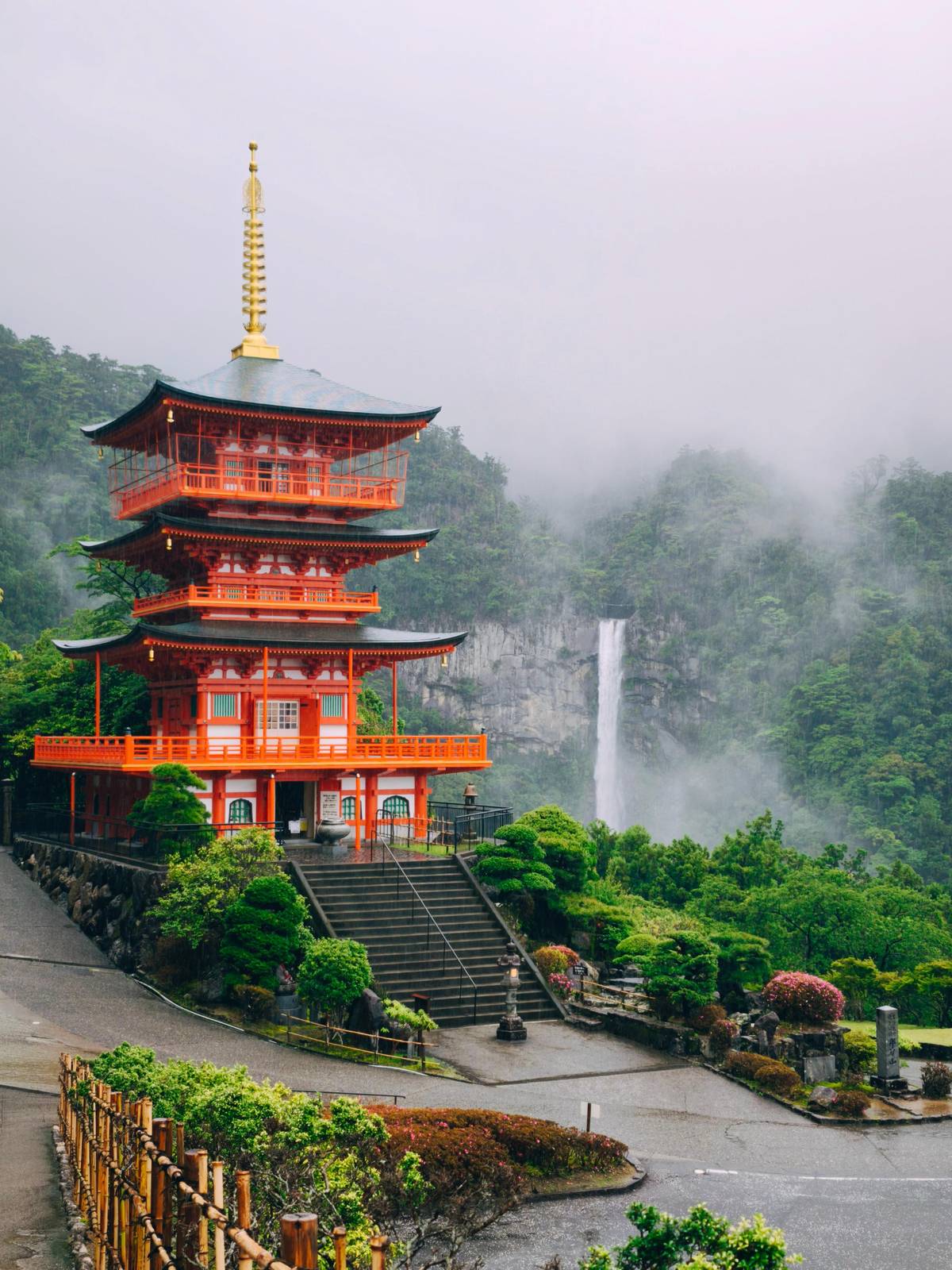
Next door is Seiganto-ji, a Tendai Buddhist temple founded, by its own tradition, in the early 5th century.52 It is the first stop of the Saigoku pilgrimage to 33 Kannon, which began in 1161.18 Its vermilion pagoda with the falls behind is the picture everyone knows from Kumano.
Shrine and temple sit side by side because Kumano mixed Shinto and Buddhist worship for centuries. You will notice the difference in the halls, the incense at the temple and the rope and paper at the shrine, but the two belong to one sacred mountain and are visited together.
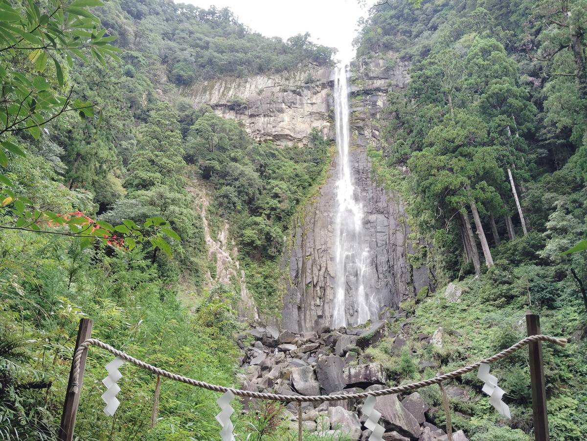
Nachi Falls, the Kumano Kodo waterfall
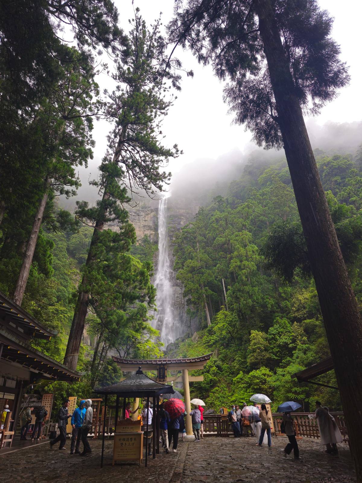
The best-known Kumano Kodo waterfall is Nachi-no-Otaki, 133 m high and 13 m wide, which the tourism bureau calls the tallest waterfall in Japan.5 Kumano Nachi Taisha adds that its plunge pool is 10 m deep and that about a tonne of water is said to fall each second.53 The shrine says the mountain holds many more, known together as the Nachi 48 falls.54
At the foot of the fall stands Hiro-jinja, a shrine with no main hall: the waterfall itself is what people bow to.6 A paid stage takes you right in front of the water, 500 yen for adults and 200 yen for school pupils, with preschool children free, as the shrine listed it in October 2026.19
The falls are also the stage of the Nachi Fire Festival, when 6 m portable shrines that represent the waterfall are purified with fire from huge torches carried by men in white.55 Check the date with the shrine before planning a visit around it, and expect large crowds that day.
Rain, heat and the time of day
Kumano is wet. The tourism bureau calls the Kii Peninsula one of the wettest areas in Japan, and it tells every walker to be ready for rain.5657 On Daimon-zaka that is not a reason to stay away: the stairs, the moss and the falls look their best under mist. It is a reason to wear shoes that grip and to bring a rain jacket rather than relying on an umbrella on narrow steps.
Summers in the region are often hot, humid and wet, and spring and fall are the popular seasons for walking.58 In the warm months start early, carry water and take the shade of the cedars as your rest stops. The stairs face little wind, and the climb feels harder in July heat than the short distance suggests.
Mornings are calmer than the middle of the day, when coach groups arrive at the shrine. The shrine office opens at 6:00, so an early bus gives you the stairs almost to yourself.17 In the busy spring and fall seasons buses can be crowded or full, so leave time for a later one.59
The best order for your visit
The tourism bureau suggests climbing the stairs to the shrine grounds first and then walking down beside the pagoda to the falls.13 That way the hard work is done early and you finish at the water, with the bus stop below. Reverse it and you climb twice.
Buses run daily from Kii-Katsuura via Nachi Station to the foot of Daimon-zaka in 20 minutes.4 Buses also run up to the Nachisan stop at the top, about 30 minutes from Kii-Katsuura, which gives you the option of riding up and walking down instead.15
From Osaka, the limited express Kuroshio takes about 4 hours from Shin-Osaka to Kii-Katsuura.60 That makes a return day trip by train long. The coach day from Osaka avoids the connections and adds Hongu and Hayatama, from $103.
Your day in Kumano
Three shrines and the cedar steps in one day.
Pick a date, meet in central Osaka, and cancel free up to 24 hours before.


You ask,we answer.
How long is the Daimon-zaka staircase?
About 600 m. It has 267 stone steps, lined with old cedars, cypress, camphor trees and bamboo.19
How long does the walk take?
About 30 minutes up the slope. Then about 20 more minutes of stairs up to the shrine complex.23
Is it a difficult walk?
Rated 1.5 of 5. Short but steep in places; the old stones are slippery when wet.214
How do I get to the start?
By bus from Kii-Katsuura. Buses go via Nachi Station to the foot of the slope in 20 minutes.4
How tall is Nachi Falls?
133 m. It is 13 m wide, and the bureau calls it Japan's tallest waterfall.5
What does the viewing stage cost?
500 yen for adults. 200 yen for school pupils, free for preschool children, as listed in October 2026.19
Can I rent a kimono for the walk?
Yes, near the foot. Daimon-zaka-chaya rents kimonos in Heian style for photos on the stairs.20
Sources
Sources and evidence
- 1Tanabe City Kumano Tourism BureauDaimon-zaka↩
- 2Tanabe City Kumano Tourism BureauDaimon-zaka↩
- 3Tanabe City Kumano Tourism BureauDaimon-zaka↩
- 4Tanabe City Kumano Tourism BureauDaimon-zaka↩
- 5Tanabe City Kumano Tourism BureauKumano Nachi Taisha↩
- 6Kumano Nachi Taisha飛瀧神社(那智御瀧) (Hiro-jinja, Nachi Falls)↩
- 7Tanabe City Kumano Tourism BureauDaimon-zaka↩
- 8Tanabe City Kumano Tourism BureauDaimon-zaka↩
- 9Tanabe City Kumano Tourism BureauDaimon-zaka↩
- 10Tanabe City Kumano Tourism BureauDaimon-zaka↩
- 11Tanabe City Kumano Tourism BureauDaimon-zaka↩
- 12Tanabe City Kumano Tourism BureauDaimon-zaka↩
- 13Tanabe City Kumano Tourism BureauDaimon-zaka↩
- 14Tanabe City Kumano Tourism BureauKumano Kodo Tips & Safety↩
- 15Kumano Nachi Taishaアクセス (Access)↩
- 16Tanabe City Kumano Tourism BureauKumano Nachi Taisha↩
- 17Tanabe City Kumano Tourism BureauKumano Nachi Taisha↩
- 18Tanabe City Kumano Tourism BureauKumano Nachi Taisha↩
- 19Kumano Nachi Taisha飛瀧神社(那智御瀧) (Hiro-jinja, Nachi Falls)↩
- 20Tanabe City Kumano Tourism BureauDaimon-zaka↩
- 21Tanabe City Kumano Tourism BureauTakijiri-oji to Tsugizakura-oji↩
- 22Tanabe City Kumano Tourism BureauTakijiri-oji to Tsugizakura-oji↩
- 23Tanabe City Kumano Tourism BureauTakijiri-oji to Takahara↩
- 24Tanabe City Kumano Tourism BureauTakijiri-oji to Takahara↩
- 25Tanabe City Kumano Tourism BureauHistory & Oji↩
- 26Tanabe City Kumano Tourism BureauChikatsuyu↩
- 27Tanabe City Kumano Tourism BureauHistory & Oji↩
- 28Tanabe City Kumano Tourism BureauTsugizakura-oji to Kumano Hongu Taisha↩
- 29Tanabe City Kumano Tourism BureauHosshinmon-oji to Kumano Hongu Taisha↩
- 30Tanabe City Kumano Tourism BureauKumano Hongu Taisha↩
- 31Tanabe City Kumano Tourism BureauKumano Hongu Taisha↩
- 32Tanabe City Kumano Tourism BureauSuggested Walks↩
- 33Tanabe City Kumano Tourism BureauSuggested Walks↩
- 34Tanabe City Kumano Tourism BureauKumano Nachi Taisha↩
- 35Tanabe City Kumano Tourism BureauKumano Hayatama Taisha↩
- 36Tanabe City Kumano Tourism BureauHosshinmon-oji to Kumano Hongu Taisha↩
- 37Tanabe City Kumano Tourism BureauKumano Hongu Taisha↩
- 38Tanabe City Kumano Tourism BureauKumano Hongu Taisha↩
- 39Tanabe City Kumano Tourism BureauYunomine Onsen↩
- 40Tanabe City Kumano Tourism BureauYunomine Onsen↩
- 41Tanabe City Kumano Tourism BureauWataze/Watarase Onsen↩
- 42Tanabe City Kumano Tourism BureauKawayu Onsen↩
- 43Tanabe City Kumano Tourism BureauKawayu Onsen↩
- 44Tanabe City Kumano Tourism BureauTransport: Train↩
- 45Tanabe City Kumano Tourism BureauKohechi↩
- 46Tanabe City Kumano Tourism BureauTransport: Train↩
- 47Tanabe City Kumano Tourism BureauKumano Kodo↩
- 48Tanabe City Kumano Tourism BureauTanabe↩
- 49Tanabe City Kumano Tourism BureauTransport: Bus↩
- 50Tanabe City Kumano Tourism BureauIseji↩
- 51Tanabe City Kumano Tourism BureauWorld Heritage: Sacred Sites and Pilgrimage Routes in the Kii Mountain Range (with the UNESCO descriptions)↩
- 52Tanabe City Kumano Tourism BureauKumano Nachi Taisha↩
- 53Kumano Nachi Taisha飛瀧神社(那智御瀧) (Hiro-jinja, Nachi Falls)↩
- 54Kumano Nachi Taisha飛瀧神社(那智御瀧) (Hiro-jinja, Nachi Falls)↩
- 55Tanabe City Kumano Tourism BureauKumano Nachi Taisha↩
- 56Tanabe City Kumano Tourism BureauKumano Kodo Tips & Safety↩
- 57Tanabe City Kumano Tourism BureauSuggested Walks↩
- 58Tanabe City Kumano Tourism BureauKumano Kodo Tips & Safety↩
- 59Tanabe City Kumano Tourism BureauKumano Kodo Tips & Safety↩
- 60Kumano Nachi Taishaアクセス (Access)↩